

Crime & Safety Report for 673 Karnak Ct, Cincinnati, OH 45233

Review crime and safety information near 673 Karnak Ct, Cincinnati, OH 45233. HoodScore summarizes nearby reported incidents, registered sex offenders, and neighborhood safety indicators to help buyers and renters perform better location due diligence.

Generated At — 2026-07-25

Distance rings: 1 mi and 2 mi from the property.

PropertyIncidentsOffenders

Unlock the full safety report before making a decision about this neighborhood.

Full report contains 209 offenders within 5 miles and 8048 crime incidents in the last 12 months.

209 Registered Sex Offenders within 5 miles Near 673 Karnak Ct, Cincinnati, OH 45233

209 Registered Offenders Nearby
62 Rape
48 Child Involved
16 Assault
94 Other
Photo Name / Age / Tags Arrest / Conviction Address Distance Risk
Offender photo

JARRETT, RICHARD ALAN

46 years old

1200 WORLDWIDE BLVD HEBRON, KY, 41048
4.4 Medium
Offender photo

MILES, JEREMY L

51 years old

Rapist

6457 GLENWAY AVE CINCINNATI, OH, 45211
3.2 Medium
Offender photo

ARENAS, DANIEL ALEXANDER

31 years old

Child Involved

603 RIVERSHORE DR HEBRON, KY, 41048
4.9 Medium
Offender photo

DIGREZIO, DAVID ALLEN

48 years old

Child Involved

1029 BLOOMFIELD CT HEBRON, KY, 41048
4.9 Medium
Offender photo

JENKINS, JUSTIN T

35 years old

Child Involved

4083 RIVER RD HEBRON, KY, 41048
2.4 Medium

8048 Crime & Incidents in the Last 12 Months

8048 Crime & Incidents by Severity
1010 Severe
1091 Medium
1381 Low
4566 Other
Crime Location (Approx.) Severity Description

Suspicious Activity

07/16/2026 10:35 PM

Cleves Warsaw Pike, Cincinnati, OH 45238

MEDIUM

As discussed during the dispatch call, officers were sent to a convenience store on Cleves Warsaw Pike for a possible unattended business. A caller reported the front door was locked but ajar, customers were inside, and no employees were visible.

Traffic

07/16/2026 10:31 PM

Warsaw Ave, Cincinnati, OH

LOW

As discussed during the dispatch call, dispatchers discuss a vehicle that reportedly fled from Delhi. The white Pontiac was last seen traveling eastbound on Warsaw Avenue near Colonial, with a temporary tag noted on the top right corner.

Traffic

07/16/2026 10:27 PM

Anderson Ferry Rd, Covedale, OH

LOW

As discussed during the dispatch call, officers reported a white Pontiac fleeing a traffic stop near Anderson Ferry Road in Covedale. The vehicle, described as having a temporary tag, apparently continued at very high speed through nearby roads including Warsaw, Simrock Trail, Cleander, and areas past Colonial before moving through the Covedale area. Units advised they were not in an active pursuit while attempting to track its direction of travel.

Break-In

07/16/2026 10:25 PM

Warsaw Ave, Cincinnati, OH 45205

Unknown

As discussed during the dispatch call, officers were dispatched to a laundromat on Warsaw Avenue for a reported rear door alarm.

Traffic

07/16/2026 10:25 PM

Westwood Ave & Van Hart St, Cincinnati, OH 45214

LOW

As discussed during the dispatch call, an officer conducted a traffic stop near Westwood Avenue and Van Hart Street in Cincinnati. The contacted person was checked, and their information apparently returned valid.

Nearby Schools

Schools within 2 miles of this property, nearest first.

SchoolDistance
C O Harrison Elementary School0.1 mi
Rapid Run Middle School1.2 mi
Delhi Middle School1.3 mi

Similar properties in Cincinnati

Other for-sale homes in Cincinnati within about 20% of this listing's price. Open a property for a HoodScore safety preview.

$264,900
2 bd | 2 ba | 1,124 sqft
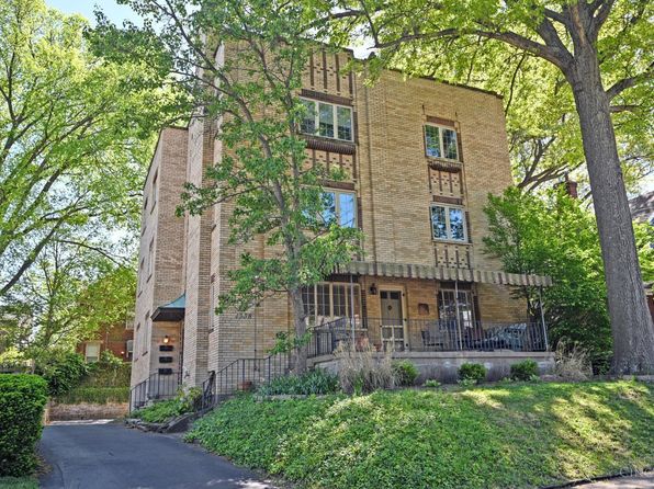
2378 Madison Rd #E1c
Cincinnati, OH, 45267
View Safety Report
$288,000
2 bd | 1 ba | 1,575 sqft
1338 Paxton Ave Unit 3
Cincinnati, OH, 45267
View Safety Report
$290,000
2 bd | 1 ba | 1,175 sqft
1427 Main St Unit 1
Cincinnati, OH, 45267
View Safety Report

Frequently asked questions

Is 673 Karnak Ct in a low-crime area?

The current report summarizes crime-related incidents within 5 miles during the last 12 months. HoodScore compares these records with relevant benchmarks, but no report can guarantee future safety.

Why are traffic and medical calls shown separately from crime?

Traffic, medical and fire records are public-safety incidents but are not necessarily crimes. HoodScore separates them to avoid overstating the crime count.

How often is this HoodScore report updated?

The report displays its generated date. Update frequency varies by source and is explained in the HoodScore methodology.

How is the HoodScore calculated?

HoodScore combines nearby crime and offender data into a neighborhood safety score. Visit https://www.hoodscore.com/hoodscore-calculator.html to see how the calculation works.