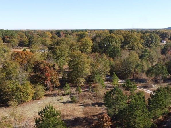
Crime & Safety Report for Blackwell Dr, Kershaw, SC 29067

Review crime and safety information near Blackwell Dr, Kershaw, SC 29067. HoodScore summarizes nearby reported incidents, registered sex offenders, and neighborhood safety indicators to help buyers and renters perform better location due diligence.

Generated At — 2026-07-25

Distance rings: 1 mi and 2 mi from the property.

PropertyIncidentsOffenders

Unlock the full safety report before making a decision about this neighborhood.

Full report contains 33 offenders within 5 miles and 8 crime incidents in the last 12 months.

33 Registered Sex Offenders within 5 miles Near Blackwell Dr, Kershaw, SC 29067

33 Registered Offenders Nearby
0 Rape
0 Child Involved
0 Assault
33 Other
Photo Name / Age / Tags Arrest / Conviction Address Distance Risk
Offender photo

JOHNSON, FREDDIE

55 years old

515 WEST RICHLAND ST KERSHAW, SC, 29067
1.5 Medium
Offender photo

ANTHONY, JERMIAH DAJAUN

27 years old

516 HAMPTON ST KERSHAW, SC, 29067
1.8 Medium
Offender photo

BARKER, MONTEZ MYHARELL

40 years old

4848 GOLD MINE HWY KERSHAW, SC, 29067
2.6 Medium
Offender photo

BELLE, DEDRICK LOUIS

54 years old

4848 GOLD MINE HWY KERSHAW, SC, 29067
2.6 Medium
Offender photo

BRANTLEY, BARRY CHRISTOPHER JR.

30 years old

6793 WYLIE CIRCLE DR KERSHAW, SC, 29067
1.9 Medium

8 Crime & Incidents in the Last 12 Months

8 Crime & Incidents by Severity
1 Medium
1 Low
6 Other
Crime Location (Approx.) Severity Description

Fire

07/14/2026 12:29 PM

Jones Rd, Kershaw, SC 29067

MEDIUM

As discussed during the dispatch call, fire crews and law enforcement were dispatched to the area of Hill Gold Mine Road and Jones Road for a reported camper on fire with heavy smoke, possibly threatening nearby structures.

Medical Emergency

07/06/2026 10:43 PM

State Rd S-28-798, Kershaw, SC 29067

Unknown

As discussed during the dispatch call, emergency medical personnel were dispatched from a nearby station to a possible respiratory emergency involving an adult man who reportedly took synthetic THC near John Gardner Road and Scott Road.

Medical Emergency

07/02/2026 07:43 PM

Hill St, Kershaw, SC 29067

Unknown

As discussed during the dispatch call, a possible medical emergency involving an 82-year-old male who fell near Hill Street Extension by Bram Avenue and Copeland Circle.

Medical Emergency

06/14/2026 05:54 PM

W Church St #126g, Kershaw, SC 29067

Unknown

As discussed during the dispatch call, a medic unit was dispatched to Trinity Apartments near Church St for an adult female experiencing an asthma attack.

Medical Emergency

06/14/2026 08:59 AM

E 4th St, Kershaw, SC 29067

Unknown

As discussed during the dispatch call, medical call for an elderly man who has fallen near South 4th Street.

Nearby Schools

Schools within 2 miles of this property, nearest first.

SchoolDistance
Kershaw Elementary1.1 mi

Similar properties in Kershaw

Other for-sale homes in Kershaw within about 20% of this listing's price. Open a property for a HoodScore safety preview.

$465,000
2 bd | 1 ba | 1,473 sqft
510 & 516 N Matson St #520
Kershaw, SC, 29067
View Safety Report
$325,000
4 bd | 2 ba | 2,560 sqft
7159 Rev Melvin Adams Rd
Kershaw, SC, 29067
View Safety Report

Frequently asked questions

Is Blackwell Dr in a low-crime area?

The current report summarizes crime-related incidents within 5 miles during the last 12 months. HoodScore compares these records with relevant benchmarks, but no report can guarantee future safety.

Why are traffic and medical calls shown separately from crime?

Traffic, medical and fire records are public-safety incidents but are not necessarily crimes. HoodScore separates them to avoid overstating the crime count.

How often is this HoodScore report updated?

The report displays its generated date. Update frequency varies by source and is explained in the HoodScore methodology.

How is the HoodScore calculated?

HoodScore combines nearby crime and offender data into a neighborhood safety score. Visit https://www.hoodscore.com/hoodscore-calculator.html to see how the calculation works.