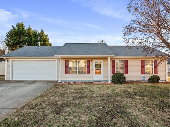
Crime & Safety Report for 106 Garrett Maxwell Rd, Anderson, SC 29626

Review crime and safety information near 106 Garrett Maxwell Rd, Anderson, SC 29626. HoodScore summarizes nearby reported incidents, registered sex offenders, and neighborhood safety indicators to help buyers and renters perform better location due diligence.

Generated At — 2026-07-25

Distance rings: 1 mi and 2 mi from the property.

PropertyIncidentsOffenders

Unlock the full safety report before making a decision about this neighborhood.

Full report contains 123 offenders within 5 miles and 505 crime incidents in the last 12 months.

123 Registered Sex Offenders within 5 miles Near 106 Garrett Maxwell Rd, Anderson, SC 29626

123 Registered Offenders Nearby
0 Rape
0 Child Involved
0 Assault
123 Other
Photo Name / Age / Tags Arrest / Conviction Address Distance Risk
Offender photo

WHITFIELD, CLEVELAND DOUGLAS

52 years old

4360 SC 24 ANDERSON, SC, 29626
2.1 Medium
Offender photo

BROOKS, ROBERT KENNETH

53 years old

925 CENTERVILLE RD ANDERSON, SC, 29625
3.3 Medium
Offender photo

SHAW, JAMES RAY JR.

68 years old

651 HWY 28 BYPASS ANDERSON, SC, 29624
3.7 Medium
Offender photo

SIMS, JERRY SELVESTER

64 years old

120 HILLCREST CIRCLE ANDERSON, SC, 29621
4.3 Medium
Offender photo

THOMPSON, JOEY D

48 years old

216 I ST ANDERSON, SC, 29621
4.8 Medium

505 Crime & Incidents in the Last 12 Months

505 Crime & Incidents by Severity
38 Severe
14 Medium
107 Low
346 Other
Crime Location (Approx.) Severity Description

Medical Emergency

07/16/2026 08:53 PM

Curtis St, Anderson, SC 29624

Unknown

As discussed during the dispatch call, a 40-year-old female reported a possible infected dog bite near Curtis Street from about two weeks ago.

Medical Emergency

07/16/2026 03:11 PM

W Whitner St, Anderson, SC 29624

Unknown

As discussed during the dispatch call, responders were dispatched for a medical emergency involving a dehydrated man with chest pain near the playground at West Whitner Street. The address was updated after communicating with the patient. Units had recently attended this location.

Fire

07/16/2026 03:06 PM

Rio Way, Anderson, SC 29625

MEDIUM

As discussed during the dispatch call, fire crews responded to a reported grass fire near a residence on Rio Way, possibly on the west side of the building. Units searched the area, found the residence apparently vacant, and the call was treated as a possible false alarm.

Medical Emergency

07/16/2026 02:52 PM

Arabian Way, Anderson, SC 29626

Unknown

As discussed during the dispatch call, emergency medical services responded to a 65-year-old female near Arabian Way. Air transport was placed on standby but later canceled. The patient was transported by Medic 4 with basic life support to a medical facility.

Medical Emergency

07/16/2026 02:04 PM

SC-24, Anderson, SC 29626

Unknown

As discussed during the dispatch call, emergency medical crews were dispatched to a Dollar General near Highway 24 for a reported sick person. A 51-year-old man was described as intoxicated and not acting normally, and was later reported to be unconscious.

Nearby Schools

Schools within 2 miles of this property, nearest first.

SchoolDistance
McLees Elementary0.4 mi

Similar properties in Anderson

Other for-sale homes in Anderson within about 20% of this listing's price. Open a property for a HoodScore safety preview.

Frequently asked questions

Is 106 Garrett Maxwell Rd in a low-crime area?

The current report summarizes crime-related incidents within 5 miles during the last 12 months. HoodScore compares these records with relevant benchmarks, but no report can guarantee future safety.

Why are traffic and medical calls shown separately from crime?

Traffic, medical and fire records are public-safety incidents but are not necessarily crimes. HoodScore separates them to avoid overstating the crime count.

How often is this HoodScore report updated?

The report displays its generated date. Update frequency varies by source and is explained in the HoodScore methodology.

How is the HoodScore calculated?

HoodScore combines nearby crime and offender data into a neighborhood safety score. Visit https://www.hoodscore.com/hoodscore-calculator.html to see how the calculation works.