Crime & Safety Report for 21 Daisytown Rd, Daisytown, PA 15427

Review crime and safety information near 21 Daisytown Rd, Daisytown, PA 15427. HoodScore summarizes nearby reported incidents, registered sex offenders, and neighborhood safety indicators to help buyers and renters perform better location due diligence.

Generated At — 2026-07-25

Distance rings: 1 mi and 2 mi from the property.

PropertyIncidentsOffenders

Unlock the full safety report before making a decision about this neighborhood.

Full report contains 136 offenders within 5 miles and 640 crime incidents in the last 12 months.

136 Registered Sex Offenders within 5 miles Near 21 Daisytown Rd, Daisytown, PA 15427

136 Registered Offenders Nearby
42 Rape
43 Child Involved
78 Assault
10 Other
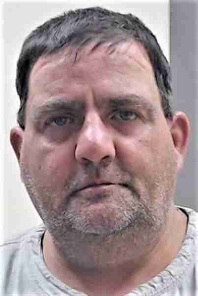
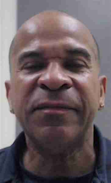
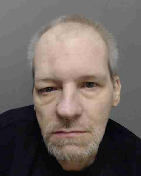
Photo Name / Age / Tags Arrest / Conviction Address Distance Risk
Offender photo

HOOVER, RICHARD

52 years old

Violent

6301 -CORRUPTION OF MINORS

2024-12-11T18:15:10

3126-INDECENT ASSAULT

2024-12-11T18:15:10

602 FURLONG AVE ROSCOE, PA, 15477
4.5 Medium
Offender photo

SETTLES, MARVIN ELLIS SR

64 years old

Rapist

Violent

3125-AGGRAVATED INDECENT ASSAULT

2024-12-11T18:15:10

3121-RAPE

2024-12-11T18:15:10

3121-RAPE

2024-12-11T18:15:10

3126-INDECENT ASSAULT

2024-12-11T18:15:10

3125-AGGRAVATED INDECENT ASSAULT

2024-12-11T18:15:10

1800 PAUL THOMAS BLVD BROWNSVILLE, PA, 15417
1.9 Medium
Offender photo

FISHER, RONALD PAUL JR

52 years old

Rapist

3123-INVOLUNTARY DEVIATE SEXUAL INTERCOURSE

2024-12-11T18:15:10

3121-RAPE

2024-12-11T18:15:10

182 SOUTH CALIFORNIA DRIVE COAL CENTER, PA, 15423
3.6 Medium
Offender photo

PESSALL, JAMES MATTHEW

36 years old

Violent

3125-AGGRAVATED INDECENT ASSAULT

2024-12-11T18:15:10

102 BACK STREET COAL CENTER, PA, 15423
2.6 Medium
Offender photo

EDGMON, RONNY EUGENE

78 years old

Child Involved

Violent

CO001-SEX ASSAULT ON CHILD

2024-12-11T18:15:10

4 POWER HOUSE RD COAL CENTER, PA, 15423
1.3 Medium

640 Crime & Incidents in the Last 12 Months

640 Crime & Incidents by Severity
92 Severe
59 Medium
111 Low
378 Other
Crime Location (Approx.) Severity Description

Suspicious Activity

07/16/2026 05:09 PM

National Pike, Fredericktown, PA 15333

MEDIUM

As discussed during the dispatch call, a caller on National Pike reported that a charcoal-colored Subaru with a Pennsylvania license plate had followed and recorded her about 20 minutes earlier before continuing toward Bentleyville. The caller requested to make a report about the suspicious vehicle.

Suspicious Activity

07/16/2026 04:18 PM

Quarry Ln, California, PA 15419

MEDIUM

As discussed during the dispatch call, officers were sent to a reportedly long-vacant house near Quarry Lane for a suspicious vehicle that had been parked there since the morning. The caller was unsure if anyone was inside.

Fire

07/16/2026 04:08 PM

Hollow Rd, Elco, PA 15423

MEDIUM

As discussed during the dispatch call, dispatch reported a possible fire alarm activation near Prairie Hollow Road and Pleasant Hill, with local fire units referenced and the alarm later reported to have reset.

Fire

07/16/2026 03:11 PM

National Pike, Richeyville, PA 15358

MEDIUM

As discussed during the dispatch call, fire crews responded to a reported carbon monoxide alarm at a business near National Pike in the Centerville and Richeyville area. The building was evacuated and no illnesses were reported.

Fire

07/16/2026 03:09 PM

National Pike, Richeyville, PA 15358

MEDIUM

As discussed during the dispatch call, fire crews were dispatched to a GetGo along National Pike in the Centerville and Richeyville area for a reported carbon monoxide detector activation. The building was evacuated and no illnesses were reported.

Nearby Schools

Schools within 2 miles of this property, nearest first.

SchoolDistance
California Area SHS0.5 mi
California Area MS0.5 mi
California Area Intermediate MS0.5 mi
California Area El Sch0.6 mi
California Academy of Learning CS0.6 mi

Frequently asked questions

Is 21 Daisytown Rd in a low-crime area?

The current report summarizes crime-related incidents within 5 miles during the last 12 months. HoodScore compares these records with relevant benchmarks, but no report can guarantee future safety.

Why are traffic and medical calls shown separately from crime?

Traffic, medical and fire records are public-safety incidents but are not necessarily crimes. HoodScore separates them to avoid overstating the crime count.

How often is this HoodScore report updated?

The report displays its generated date. Update frequency varies by source and is explained in the HoodScore methodology.

How is the HoodScore calculated?

HoodScore combines nearby crime and offender data into a neighborhood safety score. Visit https://www.hoodscore.com/hoodscore-calculator.html to see how the calculation works.