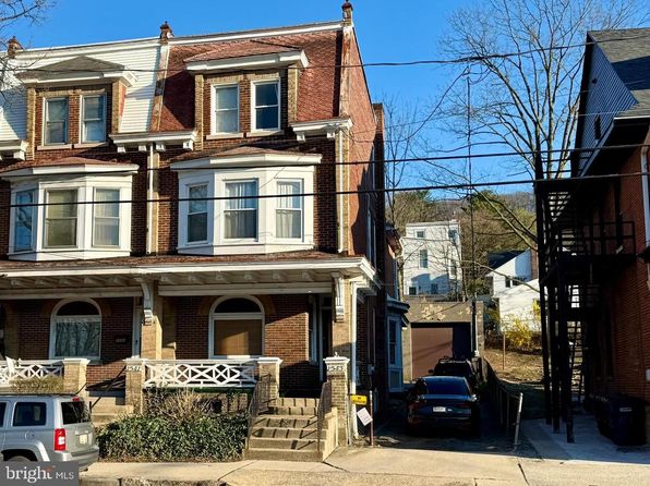


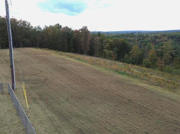
Crime & Safety Report for 17 High Rd, Hegins, PA 17901

Review crime and safety information near 17 High Rd, Hegins, PA 17901. HoodScore summarizes nearby reported incidents, registered sex offenders, and neighborhood safety indicators to help buyers and renters perform better location due diligence.

Generated At — 2026-07-25

Distance rings: 1 mi and 2 mi from the property.

PropertyIncidentsOffenders

Unlock the full safety report before making a decision about this neighborhood.

Full report contains 45 offenders within 5 miles and 82 crime incidents in the last 12 months.

45 Registered Sex Offenders within 5 miles Near 17 High Rd, Hegins, PA 17901

45 Registered Offenders Nearby
8 Rape
13 Child Involved
22 Assault
8 Other
Photo Name / Age / Tags Arrest / Conviction Address Distance Risk
Offender photo

ENGLISH, DEVIN

23 years old

Violent

3126-INDECENT ASSAULT

2024-12-11T18:15:10

1162 KEYSTONE BLVE POTTSVILLE, PA, 17901
2 Medium
Offender photo

KERSTETTER, GARY

56 years old

Child Involved

6318-UNLAWFUL CONTACT OR COMMUNICATION WITH MINOR

2024-12-11T18:15:10

1162 KEYSTONE BLVD POTTSVILLE, PA, 17901
2 Medium
Offender photo

ANDERSON, CHARLES ROBERT

40 years old

Child Involved

6312-SEXUAL ABUSE OF CHILDREN

2024-12-11T18:15:10

214 HARRISON STREET POTTSVILLE, PA, 17901
4.5 Medium
Offender photo

BAUER, KYLE LEE

30 years old

Child Involved

6312-SEXUAL ABUSE OF CHILDREN

2024-12-11T18:15:10

110 KEYSTONE BLVD. POTTSVILLE, PA, 17901
2.7 Medium
Offender photo

BARR, PHILIP JAMES

59 years old

Child Involved

3123-INVOLUNTARY DEVIATE SEXUAL INTERCOURSE

2024-12-11T18:15:10

SCHUYLKILL COUNTY PRISON POTTSVILLE, PA, 179010000
4.5 Medium

82 Crime & Incidents in the Last 12 Months

82 Crime & Incidents by Severity
38 Severe
16 Medium
8 Low
20 Other
Crime Location (Approx.) Severity Description

Road Closure

07/16/2026 12:17 PM

Carbon St & N 2nd St, Minersville, PA 17954

Unknown

As discussed during the dispatch call, radio traffic indicates deputies coordinated with utility crews to handle a possible road or utility pole hazard near Carbon Street and Second Street, extending toward North and Third streets. Units placed signs and cones to control traffic while the power company created a service ticket with no estimated arrival time given.

Fire

07/16/2026 05:56 AM

S Centre St, Pottsville, PA 17901

MEDIUM

As discussed during the dispatch call, fire crews and police responded to a reported fire alarm with smoke in a first-floor weight room at an apartment building on South Center Street in Pottsville. Officers on scene advised it was apparently set off accidentally by an employee, and responding units were downgraded to a non-emergency response and then canceled.

Fire

07/16/2026 04:26 AM

Keystone Blvd, Pottsville, PA 17901

MEDIUM

As discussed during the dispatch call, radio traffic reports a possible car fire in front of a store on Keystone Boulevard in Cass Township, with multiple fire districts and an engine dispatched. A separate medical call involves an elderly man at a residence on Clinton Avenue.

Fire

07/14/2026 03:50 PM

PA Rt 61 And, Ann St, Pottsville, PA 17901

MEDIUM

As discussed during the dispatch call, fire units responded to a commercial fire alarm at a large home improvement store near a state route intersection. A possible water flow issue was reported with the fire pump running, and the deputy chief arrived to find nothing apparent showing while staff were contacted.

Medical Emergency

07/12/2026 04:35 PM

Hill Rd, Buck Run, PA 17901

Unknown

As discussed during the dispatch call, emergency medical crews were dispatched to a location on Evans Road in Pottsville Township for an elderly woman with chest pain and a history of coronary heart disease with a stent.

Nearby Schools

Schools within 2 miles of this property, nearest first.

SchoolDistance
Minersville Area JSHS0.9 mi
Minersville Area El Ctr1.1 mi
Early Childhood Edu Ctr1.8 mi

Similar properties in Pottsville

Other for-sale homes in Pottsville within about 20% of this listing's price. Open a property for a HoodScore safety preview.

Frequently asked questions

Is 17 High Rd in a low-crime area?

The current report summarizes crime-related incidents within 5 miles during the last 12 months. HoodScore compares these records with relevant benchmarks, but no report can guarantee future safety.

Why are traffic and medical calls shown separately from crime?

Traffic, medical and fire records are public-safety incidents but are not necessarily crimes. HoodScore separates them to avoid overstating the crime count.

How often is this HoodScore report updated?

The report displays its generated date. Update frequency varies by source and is explained in the HoodScore methodology.

How is the HoodScore calculated?

HoodScore combines nearby crime and offender data into a neighborhood safety score. Visit https://www.hoodscore.com/hoodscore-calculator.html to see how the calculation works.