Crime & Safety Report for County Road 10, East Liberty, OH 43319

Review crime and safety information near County Road 10, East Liberty, OH 43319. HoodScore summarizes nearby reported incidents, registered sex offenders, and neighborhood safety indicators to help buyers and renters perform better location due diligence.

Generated At — 2026-07-26
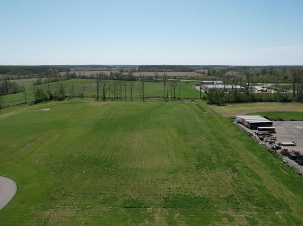
Distance rings: 1 mi and 2 mi from the property.

PropertyIncidentsOffenders

Unlock the full safety report before making a decision about this neighborhood.

Full report contains 26 offenders within 5 miles and 11 crime incidents in the last 12 months.

26 Registered Sex Offenders within 5 miles Near County Road 10, East Liberty, OH 43319

26 Registered Offenders Nearby
3 Rape
11 Child Involved
5 Assault
9 Other
Photo Name / Age / Tags Arrest / Conviction Address Distance Risk
Offender photo

ALLEN, CHARLES TIMOTHY

58 years old

Violent

21000 JOHNSON RD MARYSVILLE, OH, 43040
4.6 Medium
Offender photo

BRAGG, STACEY LAMONT

51 years old

Rapist

11000 STATE ROUTE 347 EAST LIBERTY, OH, 43319
1.2 Medium
Offender photo

CAMPBELL, DALE ANTHONY

53 years old

11000 OHIO 347 EAST LIBERTY, OH, 43319
1.2 Medium
Offender photo

JONES, ROBERT RUSSELL

44 years old

11000 SR347 RAYMOND, OH, 43067
1.2 Medium
Offender photo

KOEHLER, BRIAN KEITH

49 years old

11000 STATE ROUTE 347 EAST LIBERTY, OH, 43319
1.2 Medium

11 Crime & Incidents in the Last 12 Months

11 Crime & Incidents by Severity
1 Severe
2 Medium
3 Low
5 Other
Crime Location (Approx.) Severity Description

Medical Emergency

07/10/2026 05:18 PM

OH-347, East Liberty, OH 43319

Unknown

As discussed during the dispatch call, medic 601 was dispatched for a potential abdominal problem near State Route 347, with cross streets County Road 154 and Township Road 143.

Fire

07/10/2026 04:06 PM

Township Rd 157, East Liberty, OH 43319

MEDIUM

As discussed during the dispatch call, rescue units were dispatched to a possible carbon monoxide alarm at a location on Township Road 157 in East Liberty, Ohio.

Fire

07/10/2026 11:33 AM

OH-739, Marysville, OH 43040

MEDIUM

As discussed during the dispatch call, rescue units responded to a reported commercial fire alarm at a credit union near State Route 739 and Old US Highway 33. Crews arrived to find a two-story small commercial building with nothing visible and began investigating under a lieutenant’s command.

Medical Emergency

07/06/2026 06:26 AM

Township Rd 298, East Liberty, OH 43319

Unknown

As discussed during the dispatch call, medic 601 dispatched to a sick person near Midwest Express, Township Road 298. Cross streets are Township 157A and State Route 287.

Assault

06/26/2026 01:07 PM

Storms Rd, West Mansfield, OH 43358

SERIOUS

As discussed during the dispatch call, officers on Storms Road detained an adult man after a reported confrontation that led to a taser being used twice. Medics were requested to the location to check on the man, who was described as injured but secured and in custody. A witness inside a nearby residence was asked to be added to the call.

Frequently asked questions

Is County Road 10 in a low-crime area?

The current report summarizes crime-related incidents within 5 miles during the last 12 months. HoodScore compares these records with relevant benchmarks, but no report can guarantee future safety.

Why are traffic and medical calls shown separately from crime?

Traffic, medical and fire records are public-safety incidents but are not necessarily crimes. HoodScore separates them to avoid overstating the crime count.

How often is this HoodScore report updated?

The report displays its generated date. Update frequency varies by source and is explained in the HoodScore methodology.

How is the HoodScore calculated?

HoodScore combines nearby crime and offender data into a neighborhood safety score. Visit https://www.hoodscore.com/hoodscore-calculator.html to see how the calculation works.