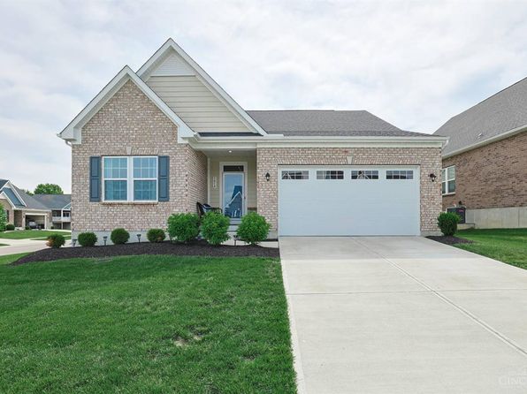


Crime & Safety Report for 6702 Eldorado Dr, Liberty Township, OH 45044

Review crime and safety information near 6702 Eldorado Dr, Liberty Township, OH 45044. HoodScore summarizes nearby reported incidents, registered sex offenders, and neighborhood safety indicators to help buyers and renters perform better location due diligence.

Generated At — 2026-07-25

Distance rings: 1 mi and 2 mi from the property.

PropertyIncidentsOffenders

Unlock the full safety report before making a decision about this neighborhood.

Full report contains 90 offenders within 5 miles and 679 crime incidents in the last 12 months.

90 Registered Sex Offenders within 5 miles Near 6702 Eldorado Dr, Liberty Township, OH 45044

90 Registered Offenders Nearby
11 Rape
23 Child Involved
5 Assault
51 Other
Photo Name / Age / Tags Arrest / Conviction Address Distance Risk
Offender photo

ADAMS, MICHAEL ANDREW

53 years old

Violent

7201 SNIDER RD MASON, OH, 45040
4.1 Medium
Offender photo

REDDING, CHRISTOPHER SCOTT

34 years old

Child Involved

7325 SNIDER RD MASON, OH, 45040
4.2 Medium
Offender photo

BOGGS, JEREMY RAY

47 years old

175 SENATE DR MONROE, OH, 45050
4.8 Medium
Offender photo

CARNES, NICHOLAS ADAM

40 years old

1275 HAMILTON LEBANON RD E MONROE, OH, 45050
4.7 Medium
Offender photo

CROSSGROVE, CALEB DANIEL

34 years old

299 EXPLORATION DR MONROE, OH, 45050
3.9 Medium

679 Crime & Incidents in the Last 12 Months

679 Crime & Incidents by Severity
70 Severe
84 Medium
201 Low
324 Other
Crime Location (Approx.) Severity Description

Traffic

07/16/2026 08:32 PM

Lakeshore Dr, Monroe, OH 45050

LOW

As discussed during the dispatch call, dispatchers report a traffic crash with injuries near a residence on Lakeshore Drive in Monroe involving a Subaru and a Hyundai. Responders are advised to separate the vehicles, and one unit is routing to West Chester Hospital.

Suspicious Activity

07/16/2026 08:14 PM

Mason Montgomery Rd, Mason, OH

MEDIUM

As discussed during the dispatch call, dispatch reports a possible suspicious person near Tyler’s Trail and Mason Montgomery Road in Mason, Ohio, and assigns the closest unit to respond.

Suspicious Call

07/16/2026 06:58 PM

Shepherd Farm Dr, West Chester Township, OH 45069

Unknown

As discussed during the dispatch call, officers investigated a possible 911 hang up at an apartment in a residential complex on Shepherd Farm Drive, reported to be from a unit referred to as the Willows. A woman briefly spoke to dispatch about an emergency location before the call disconnected, and a callback reached an open line. Staff on scene did not know who called. Management planned to open the apartment, but officers later advised this was not needed because they had already entered through an open door.

Robbery Report

07/16/2026 06:55 PM

Spyglass Hill, Mason, OH 45040

Unknown

As discussed during the dispatch call, an officer attempts to contact the owner of a transportation company at a residence near Spyglass Hill to get more information about a reported truck driver robbery in Missouri.

Traffic

07/16/2026 06:16 PM

Western Row Rd & Industrial Row Rd, Mason, OH 45040

LOW

As discussed during the dispatch call, officers conducted a traffic stop near Western Row Road and Industrial Row Road involving a vehicle initially believed to have a North Carolina license plate, later clarified as registered in South Carolina. A woman associated with the stop was checked and reportedly appeared okay.

Nearby Schools

Schools within 2 miles of this property, nearest first.

SchoolDistance
Lakota East High School0.4 mi
Liberty Junior School0.7 mi
Woodland Elementary School0.7 mi
Independence Elementary School0.9 mi

Similar properties in Middletown

Other for-sale homes in Middletown within about 20% of this listing's price. Open a property for a HoodScore safety preview.

$549,900
3 bd | 3 ba | 2,706 sqft
5814 Caitlyn Rose Ln
Middletown, OH, 45044
View Safety Report
$555,000
4 bd | 4 ba | 3,285 sqft
5731 Caitlyn Rose Ln
Middletown, OH, 45044
View Safety Report

Frequently asked questions

Is 6702 Eldorado Dr in a low-crime area?

The current report summarizes crime-related incidents within 5 miles during the last 12 months. HoodScore compares these records with relevant benchmarks, but no report can guarantee future safety.

Why are traffic and medical calls shown separately from crime?

Traffic, medical and fire records are public-safety incidents but are not necessarily crimes. HoodScore separates them to avoid overstating the crime count.

How often is this HoodScore report updated?

The report displays its generated date. Update frequency varies by source and is explained in the HoodScore methodology.

How is the HoodScore calculated?

HoodScore combines nearby crime and offender data into a neighborhood safety score. Visit https://www.hoodscore.com/hoodscore-calculator.html to see how the calculation works.