
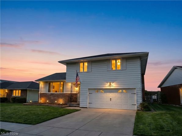
Crime & Safety Report for 4633 Whitehall Dr, South Euclid, OH 44121

Review crime and safety information near 4633 Whitehall Dr, South Euclid, OH 44121. HoodScore summarizes nearby reported incidents, registered sex offenders, and neighborhood safety indicators to help buyers and renters perform better location due diligence.

Generated At — 2026-07-26
Distance rings: 1 mi and 2 mi from the property.

PropertyIncidentsOffenders

Unlock the full safety report before making a decision about this neighborhood.

Full report contains 500 offenders within 5 miles and 13688 crime incidents in the last 12 months.

500 Registered Sex Offenders within 5 miles Near 4633 Whitehall Dr, South Euclid, OH 44121

500 Registered Offenders Nearby
122 Rape
130 Child Involved
80 Assault
196 Other
Photo Name / Age / Tags Arrest / Conviction Address Distance Risk
Offender photo

BOWLING, DAVID

33 years old

Child Involved

13530 CEDAR RD UNIVERSITY HEIGHTS, OH, 44118
2.9 Medium
Offender photo

FLANAGAN, BRENDA J

61 years old

Rapist

1365 E 114TH ST CLEVELAND, OH, 44106
4.9 Medium
Offender photo

LEHRI, ALEX

53 years old

Violent

1532 E 118TH ST CLEVELAND, OH, 44106
4.8 Medium
Offender photo

SMITH, ERNEST GLENN

58 years old

Violent

1474 E 123RD ST CLEVELAND, OH, 44106
4.6 Medium
Offender photo

CONLEY, JASON EDWIN

37 years old

Child Involved

775 SOM CENTER RD MAYFIELD VILLAGE, OH, 44143
3.9 Medium

13688 Crime & Incidents in the Last 12 Months

13688 Crime & Incidents by Severity
2122 Severe
1989 Medium
3114 Low
6463 Other
Crime Location (Approx.) Severity Description

Traffic

07/16/2026 10:42 PM

Superior Ave & E 115th St, Cleveland, OH 44108

LOW

As discussed during the dispatch call, officers conduct a traffic stop near Superior Avenue and East 115th Street, possibly involving a vehicle with a specific license plate.

Medical Emergency

07/16/2026 10:26 PM

Wilmore Ave, Euclid, OH 44123

Unknown

As discussed during the dispatch call, a possible medical emergency involving a female was reported near Wilmore Avenue. Emergency units Station One and Medic One were dispatched. The female reportedly has a medical GPS device.

Medical Emergency

07/16/2026 10:26 PM

Superior Av & E 123rd St, Cleveland, OH 44108

Unknown

As discussed during the dispatch call, officer requested to check on someone near Superior Avenue and East 123rd Street. The situation appears to involve a possible medical emergency.

Medical Emergency

07/16/2026 10:21 PM

Terrace Rd, East Cleveland, OH 44112

Unknown

As discussed during the dispatch call, a medical emergency was reported near Terrace Road in East Cleveland. A patient, age 69, was experiencing difficulty breathing. Emergency unit 42 responded to the scene.

Medical Emergency

07/16/2026 10:21 PM

Terrace Rd, East Cleveland, OH

Unknown

As discussed during the dispatch call, emergency crews responded to an apparent medical emergency at an apartment building on Terrace Road in East Cleveland for a 69-year-old woman who was reportedly having difficulty breathing and unable to meet responders in the lobby.

Nearby Schools

Schools within 2 miles of this property, nearest first.

SchoolDistance
Memorial Junior High School0.4 mi
Brush High School0.7 mi
Adrian Elementary School0.7 mi
Flex High School Cleveland1.2 mi
Greenview Upper Elementary School1.3 mi
Noble Elementary School1.5 mi
Rowland Elementary School1.6 mi
Oxford Elementary School1.7 mi
Monticello Middle School1.9 mi
Millridge Elementary School1.9 mi
Richmond Heights Elementary School2.0 mi
Richmond Heights High School2.0 mi
Richmond Heights Middle School2.0 mi

Similar properties in Cleveland

Other for-sale homes in Cleveland within about 20% of this listing's price. Open a property for a HoodScore safety preview.

$325,000
1 bd | 2 ba | 1,112 sqft
2425 Derbyshire Ct #B4-c
Cleveland, OH, 44101
View Safety Report
$299,999
2 bd | 2 ba | 1,478 sqft
2222 Detroit Ave APT 1012
Cleveland, OH, 44101
View Safety Report

Frequently asked questions

Is 4633 Whitehall Dr in a low-crime area?

The current report summarizes crime-related incidents within 5 miles during the last 12 months. HoodScore compares these records with relevant benchmarks, but no report can guarantee future safety.

Why are traffic and medical calls shown separately from crime?

Traffic, medical and fire records are public-safety incidents but are not necessarily crimes. HoodScore separates them to avoid overstating the crime count.

How often is this HoodScore report updated?

The report displays its generated date. Update frequency varies by source and is explained in the HoodScore methodology.

How is the HoodScore calculated?

HoodScore combines nearby crime and offender data into a neighborhood safety score. Visit https://www.hoodscore.com/hoodscore-calculator.html to see how the calculation works.