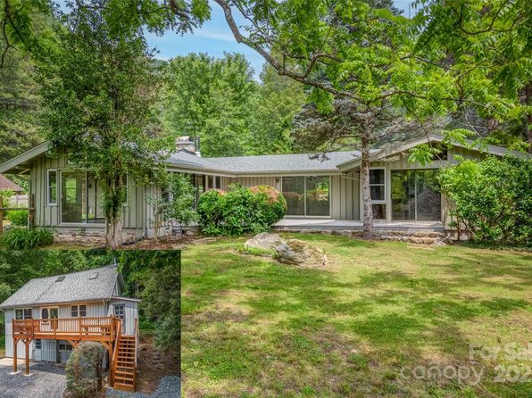
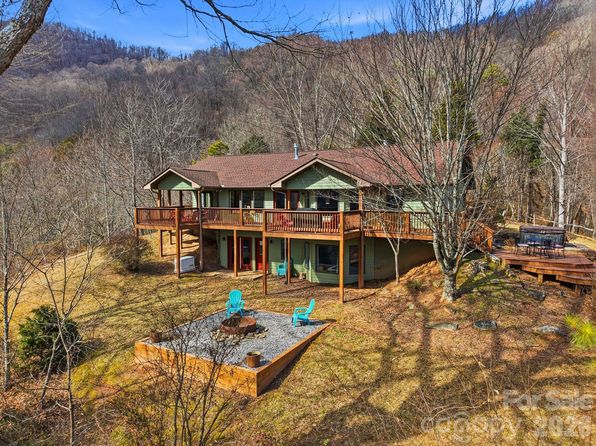
Crime & Safety Report for 9065 State Highway 63, Leicester, NC 28748

Review crime and safety information near 9065 State Highway 63, Leicester, NC 28748. HoodScore summarizes nearby reported incidents, registered sex offenders, and neighborhood safety indicators to help buyers and renters perform better location due diligence.

Generated At — 2026-07-26

Distance rings: 1 mi and 2 mi from the property.

PropertyIncidentsOffenders

Unlock the full safety report before making a decision about this neighborhood.

Full report contains 5 offenders within 5 miles and 18 crime incidents in the last 12 months.

5 Registered Sex Offenders within 5 miles Near 9065 State Highway 63, Leicester, NC 28748

5 Registered Offenders Nearby
0 Rape
4 Child Involved
0 Assault
1 Other
Photo Name / Age / Tags Arrest / Conviction Address Distance Risk
Offender photo

MARVIL, FREDERICK L

59 years old

REGISTERED AS A RESULT OF OUT-OF-STATE CONVICTION

2024-12-17T08:38:16

12 RUBLE DR LEICESTER, NC, 28748
3.7 Medium
Offender photo

WEBB, CECIL J

65 years old

Child Involved

INDECENT LIBERTY MINOR

2024-12-17T08:38:16

INDECENT LIBERTY MINOR

2024-12-17T08:38:16

INDECENT LIBERTY MINOR

2024-12-17T08:38:16

41 PARHAM ROAD LEICESTER, NC, 28748
3.9 Medium
Offender photo

HENSLEY, JOHN WAYNE

58 years old

Child Involved

INDECENT LIBERTY MINOR

2024-12-17T08:38:16

127 HENSLEY DR MARSHALL, NC, 28753
3.8 Medium
Offender photo

STEPHENS, DWAYNE A

53 years old

Child Involved

INDECENT LIBERTY MINOR

2024-12-17T08:38:16

INDECENT LIBERTY MINOR

2024-12-17T08:38:16

INDECENT LIBERTY MINOR

2024-12-17T08:38:16

25 CHIMERA COURT MARSHALL, NC, 28753
4.3 Medium
Offender photo

TEAGUE, JOSHUA MCKINLEY

41 years old

Child Involved

REGISTERED AS A RESULT OF OUT-OF-STATE CONVICTION

2024-12-17T08:38:16

148 OAK HILL DR MARSHALL, NC, 28753
3.8 Medium

18 Crime & Incidents in the Last 12 Months

18 Crime & Incidents by Severity
1 Medium
3 Low
14 Other
Crime Location (Approx.) Severity Description

Medical Emergency

07/16/2026 10:59 AM

New Leicester Hwy, Leicester, NC 28748

Unknown

As discussed during the dispatch call, medical call for suspected chest pain near New Leicester Highway and Webb Hill Road. Responding unit is Station 18-1 on B fire med.

Traffic

07/14/2026 02:34 PM

New Leicester Hwy, Leicester, NC 28748

LOW

As discussed during the dispatch call, emergency units responded to a reported motor vehicle accident in the 5700 block of New Leicester Highway near Tradewind Drive. Rescue crews later reported a two-car collision with no apparent personal injuries.

Traffic

07/12/2026 06:46 PM

New Leicester Hwy, Leicester, NC 28748

LOW

As discussed during the dispatch call, fire units were dispatched to a possible vehicle collision in the (number withheld) block of New Leicester Highway near Druid Drive and Mooseheart Lane. Crews searched the area, did not find a crash, and returned to service.

Medical Emergency

07/10/2026 05:01 AM

Indian Hill Dr, Leicester, NC 28748

Unknown

As discussed during the dispatch call, a medical emergency involving breathing problems is reported near Indian Hill Drive and Indian Ridge Drive. Responders are dispatched with fire medical support.

Medical Emergency

07/06/2026 09:21 AM

Jericho Rd, Leicester, NC 28748

Unknown

As discussed during the dispatch call, a medical emergency involving a fall was reported near Jericho Road. The caller said he had fallen in the past week and requested transport to the VA. Emergency responders were dispatched to investigate.

Similar properties in Leicester

Other for-sale homes in Leicester within about 20% of this listing's price. Open a property for a HoodScore safety preview.

$1,650,000
4 bd | 3 ba | 3,449 sqft
54 Mountain Shadows Dr
Leicester, NC, 28748
View Safety Report
$1,499,750
5 bd | 6 ba | 5,142 sqft
24 Chapel Hill Ln #40
Leicester, NC, 28748
View Safety Report
$1,799,000
5 bd | 4 ba | 3,645 sqft
8749 State Highway 63
Leicester, NC, 28748
View Safety Report

Frequently asked questions

Is 9065 State Highway 63 in a low-crime area?

The current report summarizes crime-related incidents within 5 miles during the last 12 months. HoodScore compares these records with relevant benchmarks, but no report can guarantee future safety.

Why are traffic and medical calls shown separately from crime?

Traffic, medical and fire records are public-safety incidents but are not necessarily crimes. HoodScore separates them to avoid overstating the crime count.

How often is this HoodScore report updated?

The report displays its generated date. Update frequency varies by source and is explained in the HoodScore methodology.

How is the HoodScore calculated?

HoodScore combines nearby crime and offender data into a neighborhood safety score. Visit https://www.hoodscore.com/hoodscore-calculator.html to see how the calculation works.