Crime & Safety Report for 6911 Seaside Palms Pl, Sunset Beach, NC

Review crime and safety information near 6911 Seaside Palms Pl, Sunset Beach, NC. HoodScore summarizes nearby reported incidents, registered sex offenders, and neighborhood safety indicators to help buyers and renters perform better location due diligence.

Generated At — 2026-07-25
Distance rings: 1 mi and 2 mi from the property.

PropertyIncidentsOffenders

Unlock the full safety report before making a decision about this neighborhood.

Full report contains 24 offenders within 5 miles and 1252 crime incidents in the last 12 months.

24 Registered Sex Offenders within 5 miles Near 6911 Seaside Palms Pl, Sunset Beach, NC

24 Registered Offenders Nearby
2 Rape
13 Child Involved
1 Assault
10 Other
Photo Name / Age / Tags Arrest / Conviction Address Distance Risk
Offender photo

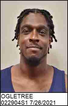
OGLETREE, WILLIAM EDWARD III

48 years old

1650 WARD RD LONGWOOD, NC, 28452
4.5 Medium
Offender photo

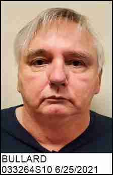
BULLARD, JAMES FREDRICK

67 years old

Child Involved

REGISTERED AS A RESULT OF OUT-OF-STATE CONVICTION

2024-12-17T08:38:16

5699 WATTS RD OCEAN ISLE BEACH, NC, 28469
2.9 Medium
Offender photo

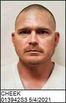
CHEEK, CAREY DALE

39 years old

Child Involved

INDECENT LIBERTY MINOR

2024-12-17T08:38:16

311 GREEN BAY RD OCEAN ISLE BEACH, NC, 28469
1.6 Medium
Offender photo

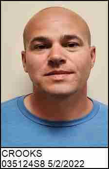
CROOKS, BRADLEY MICHAEL

38 years old

1050 WILSON AVE CALABASH, NC, 28467
4.4 Medium
Offender photo

GAUSE, JAMES A

53 years old

Rapist

RAPE 2ND DEGREE

2024-12-17T08:38:16

5552 BEACH DR SW SHALLOTTE, NC, 28470
4.8 Medium

1252 Crime & Incidents in the Last 12 Months

1252 Crime & Incidents by Severity
137 Severe
137 Medium
248 Low
730 Other
Crime Location (Approx.) Severity Description

Medical Emergency

07/16/2026 06:32 PM

8th St, Sunset Beach, NC 28468

Unknown

As discussed during the dispatch call, firefighters responded to a medical assist on a bridge near 8th St in Sunset Beach.

Traffic

07/16/2026 06:18 PM

Main St E, Sunset Beach, NC 28468

LOW

As discussed during the dispatch call, an officer initiated a traffic stop near the 1700 block of East Main Street in Sunset Beach and ran a North Carolina vehicle tag before canceling the stop and clearing the traffic enforcement activity.

Traffic

07/16/2026 06:10 PM

Causeway Dr, Ocean Isle Beach, NC 28469

LOW

As discussed during the dispatch call, dispatch received a report of a dark-colored truck pulling a flatbed trailer driving recklessly and nearly hitting several vehicles head-on while traveling southbound toward Ocean Isle Beach. An officer then located a truck matching that description near a Marathon station on Causeway Drive and made contact with the vehicle.

Medical Emergency

07/16/2026 06:03 PM

Ocean View Dr SW, Ocean Isle Beach, NC 28469

Unknown

As discussed during the dispatch call, a welfare check occurred near Ocean View Drive with units dispatched. The contact appears to have been accidental or resolved without incident.

Fire

07/16/2026 05:44 PM

38th St, Sunset Beach, NC 28468

MEDIUM

As discussed during the dispatch call, fire units respond to a possible fire hazard involving a grill located under a house near 38th Street in Sunset Beach.

Frequently asked questions

Is 6911 Seaside Palms Pl in a low-crime area?

The current report summarizes crime-related incidents within 5 miles during the last 12 months. HoodScore compares these records with relevant benchmarks, but no report can guarantee future safety.

Why are traffic and medical calls shown separately from crime?

Traffic, medical and fire records are public-safety incidents but are not necessarily crimes. HoodScore separates them to avoid overstating the crime count.

How often is this HoodScore report updated?

The report displays its generated date. Update frequency varies by source and is explained in the HoodScore methodology.

How is the HoodScore calculated?

HoodScore combines nearby crime and offender data into a neighborhood safety score. Visit https://www.hoodscore.com/hoodscore-calculator.html to see how the calculation works.