Crime & Safety Report for 504 Woodfield Dr, Asheville, NC

Review crime and safety information near 504 Woodfield Dr, Asheville, NC. HoodScore summarizes nearby reported incidents, registered sex offenders, and neighborhood safety indicators to help buyers and renters perform better location due diligence.

Generated At — 2026-07-26

Distance rings: 1 mi and 2 mi from the property.

PropertyIncidentsOffenders

Unlock the full safety report before making a decision about this neighborhood.

Full report contains 79 offenders within 5 miles and 1361 crime incidents in the last 12 months.

79 Registered Sex Offenders within 5 miles Near 504 Woodfield Dr, Asheville, NC

79 Registered Offenders Nearby
6 Rape
38 Child Involved
3 Assault
37 Other
Photo Name / Age / Tags Arrest / Conviction Address Distance Risk
Offender photo

GUNKLE, JOHN DAVID

59 years old

6 KENILWORTH KNOLL ASHEVILLE, NC, 28805
3.7 Medium
Offender photo

EMERSON, RALPH P

75 years old

Child Involved

LAST REPORTED ADDRESS - OUT OF STATE ASHVILLE, NC, 32801
4.9 Medium
Offender photo

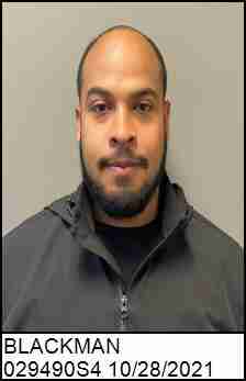
BLACKMAN, DAYSHAWN ALAN

30 years old

10 ALEXANDER DR APT 323 ASHEVILLE, NC, 28801
4.3 Medium
Offender photo

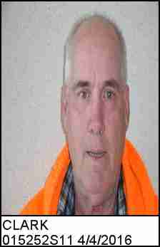
CLARK, JOHN DOUGLAS

71 years old

91 VICTORIA RD ASHEVILLE, NC, 28801
4.3 Medium
Offender photo

COLINDRES, JOSE RIGO

29 years old

20 DAVIDSON DR BCDF ASHEVILLE, NC, 28801
4.7 Medium

1361 Crime & Incidents in the Last 12 Months

1361 Crime & Incidents by Severity
163 Severe
60 Medium
104 Low
1034 Other
Crime Location (Approx.) Severity Description

Medical Emergency

07/16/2026 06:45 PM

Battle Rd, Asheville, NC 28803

Unknown

As discussed during the dispatch call, a medical emergency involving a suspected stroke was reported near Battle Road close to Dalton Street in Asheville. Emergency units were dispatched to the scene.

Traffic

07/16/2026 04:49 PM

Thompson St & Glendale Ave, Asheville, NC 28803

LOW

As discussed during the dispatch call, responders investigated a possible two-car crash near Glendale Avenue and Thompson Street, later described as near Glendale and Mill Avenue, with one lane of Glendale Avenue blocked and no apparent injuries. The scene was turned over to police.

Medical Emergency

07/16/2026 02:34 PM

123-A Hendersonville Rd, Asheville, NC 28803

Unknown

As discussed during the dispatch call, emergency crews responded to a reported accidental overdose near Hendersonville Road, with staff on scene having taken an unknown substance from the person involved. Units also checked nearby areas after reports of smoke that were believed to be from a structure fire.

Medical Emergency

07/16/2026 01:39 PM

Ballantree Dr, Asheville, NC 28803

Unknown

As discussed during the dispatch call, a medical call was received for a fall near Ballantree Drive close to Braddock Way and Gardenwood Drive. Engine 4 was dispatched for fire and medical response.

Medical Emergency

07/16/2026 01:24 PM

Woodfin St, Asheville, NC 28801

Unknown

As discussed during the dispatch call, a medical emergency was reported near Woodfin Street in Asheville. Responders indicated the incident may be across from the Asheville Community Theater near the Renaissance Hotel. The subject was later found sleeping.

Nearby Schools

Schools within 2 miles of this property, nearest first.

SchoolDistance
Reynolds Middle0.4 mi
Reynolds High0.6 mi
Oakley Elementary1.9 mi

Frequently asked questions

Is 504 Woodfield Dr in a low-crime area?

The current report summarizes crime-related incidents within 5 miles during the last 12 months. HoodScore compares these records with relevant benchmarks, but no report can guarantee future safety.

Why are traffic and medical calls shown separately from crime?

Traffic, medical and fire records are public-safety incidents but are not necessarily crimes. HoodScore separates them to avoid overstating the crime count.

How often is this HoodScore report updated?

The report displays its generated date. Update frequency varies by source and is explained in the HoodScore methodology.

How is the HoodScore calculated?

HoodScore combines nearby crime and offender data into a neighborhood safety score. Visit https://www.hoodscore.com/hoodscore-calculator.html to see how the calculation works.