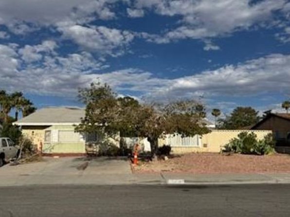
Crime & Safety Report for 5450 Oxbow St, Las Vegas, NV 89119

Review crime and safety information near 5450 Oxbow St, Las Vegas, NV 89119. HoodScore summarizes nearby reported incidents, registered sex offenders, and neighborhood safety indicators to help buyers and renters perform better location due diligence.

Generated At — 2026-07-26
Distance rings: 1 mi and 2 mi from the property.

PropertyIncidentsOffenders

Unlock the full safety report before making a decision about this neighborhood.

Full report contains 500 offenders within 5 miles and 3543 crime incidents in the last 12 months.

500 Registered Sex Offenders within 5 miles Near 5450 Oxbow St, Las Vegas, NV 89119

500 Registered Offenders Nearby
61 Rape
199 Child Involved
64 Assault
238 Other
Photo Name / Age / Tags Arrest / Conviction Address Distance Risk
Offender photo

WHITE, RICHARD CROSBY

81 years old

Child Involved

Violent

SEX OFFENSE, OTHER STATE (Sexual Assault on a Child)

2024-09-02T17:06:34

LAST REPORTED ADDRESS - OUT OF STATE LAS VEGAS, NV, 89120
1.6 Medium
Offender photo

COPELAND, DEVON LAVELLE

59 years old

LAST REPORTED ADDRESS - OUT OF STATE LAS VEGAS, NV, 89109
3.6 Medium
Offender photo

ROGERS, TERRELL

47 years old

Child Involved

AGGRAVATED CRIMINAL SEXUAL ABUSE/VICTIM 13-16 and AGGRAVATED CRIMINAL SEXUAL ABUSE/VICTIM 13-16 and CHILD SEX OFFENDER PRESENT IN A SCHOOL ZONE

2024-10-25T06:34:59

3149 DESERT INN RD 21 21 LAS VEGAS, NV, 89121
2.8 Medium
Offender photo

HILL, RANDY LEE

54 years old

Violent

129 E FREMONT ST LAS VEGAS, NV, 89101
4.5 Medium
Offender photo

PRATT, RASHEA CORVELL

42 years old

PANDERING

2024-12-21T07:03:06

525 E SAINT LOUIS AVE 225 LAS VEGAS, NV, 89104
4.2 Medium

3543 Crime & Incidents in the Last 12 Months

3543 Crime & Incidents by Severity
269 Severe
332 Medium
1159 Low
1783 Other
Crime Location (Approx.) Severity Description

Traffic

07/16/2026 11:12 PM

E Tropicana Ave, Las Vegas, NV 89119

LOW

As discussed during the dispatch call, officers received a complaint about a possible reckless driver in a white sedan on northbound I-15 near Tropicana. The vehicle was reportedly unable to stay in its lane and nearly collided with other cars before it was last seen traveling at high speed.

Traffic

07/16/2026 10:59 PM

E Windmill Ln, Las Vegas, NV 89123

LOW

As discussed during the dispatch call, dispatchers report a suspected carjacking involving a gray 2005 Chrysler, with the victim injured and the vehicle tracked using a phone left inside. The vehicle is associated with locations on Stanley Avenue and an area near Windmill and State Route 160. A separate traffic contact involves a blue Buick with a Nevada plate, which appears to have a valid permit.

Traffic

07/16/2026 10:35 PM

NV-592, Las Vegas Valley, NV

LOW

As discussed during the dispatch call, officers were notified of a possible reckless driver in a black Jeep on the beltway northbound near Flamingo Road in the Las Vegas area. The vehicle was reported swerving between lanes and speeding around corners before the caller lost sight of it.

Medical Emergency

07/16/2026 10:06 PM

High View Dr, Henderson, NV 89014

Unknown

As discussed during the dispatch call, a medical call was made for back pain at an apartment near High View Drive in Henderson.

Fire

07/16/2026 08:56 PM

E Warm Springs Rd, Las Vegas, NV 89119

MEDIUM

As discussed during the dispatch call, fire crews respond to a possible fire alarm activation near East Warm Springs Road, reportedly triggered from a pull station in one of the buildings. The responsible party or maintenance is being contacted to come to the scene.

Nearby Schools

Schools within 2 miles of this property, nearest first.

SchoolDistance
Ward Gene ES0.3 mi
Dailey Jack ES0.4 mi
Cannon Helen C JHS0.8 mi
French Doris ES1.2 mi
Del Sol Academy of Performing Arts HS1.3 mi
Rowe Lewis E ES1.4 mi
Girls Empowerment Middle School1.6 mi
Paradise Prof Dev ES1.8 mi
Stewart Helen J1.9 mi
NV Learning Academy J-SHS2.0 mi
NV Learning Academy ES2.0 mi

Frequently asked questions

Is 5450 Oxbow St in a low-crime area?

The current report summarizes crime-related incidents within 5 miles during the last 12 months. HoodScore compares these records with relevant benchmarks, but no report can guarantee future safety.

Why are traffic and medical calls shown separately from crime?

Traffic, medical and fire records are public-safety incidents but are not necessarily crimes. HoodScore separates them to avoid overstating the crime count.

How often is this HoodScore report updated?

The report displays its generated date. Update frequency varies by source and is explained in the HoodScore methodology.

How is the HoodScore calculated?

HoodScore combines nearby crime and offender data into a neighborhood safety score. Visit https://www.hoodscore.com/hoodscore-calculator.html to see how the calculation works.