Crime & Safety Report for Beechnut Rd, Stover, MO 65078

Review crime and safety information near Beechnut Rd, Stover, MO 65078. HoodScore summarizes nearby reported incidents, registered sex offenders, and neighborhood safety indicators to help buyers and renters perform better location due diligence.

Generated At — 2026-07-25
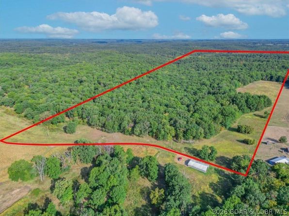
Distance rings: 1 mi and 2 mi from the property.

PropertyIncidentsOffenders

Unlock the full safety report before making a decision about this neighborhood.

Full report contains 7 offenders within 5 miles and 14 crime incidents in the last 12 months.

7 Registered Sex Offenders within 5 miles Near Beechnut Rd, Stover, MO 65078

7 Registered Offenders Nearby
3 Rape
2 Child Involved
2 Assault
2 Other
Photo Name / Age / Tags Arrest / Conviction Address Distance Risk
Offender photo

GRAMS, FRANK LEROY

55 years old

Child Involved

Rapist

Rape

2024-12-20T10:58:19

25612 EDS TURN UNINC MORGAN COUNTY, MO, 65084
4 Medium
Offender photo

BLOCHER, RYAN GENE

44 years old

Child Involved

Prom Child Porno-2nd Deg

2024-12-20T10:58:19

2475 MINNOW BRANCH RD UNINC MORGAN COUNTY, MO, 65078
1.5 Medium
Offender photo

GRIFFITHS, ROBERT DELACYWHITT

47 years old

Rapist

Att Rape 2nd Degree

2024-12-20T10:58:19

Attempted Rape 2nd Degree

2024-12-20T10:58:19

1255 BLUFF RD UNINC MORGAN COUNTY, MO, 65078
4.1 Medium
Offender photo

JONES, RICKY LASAIL

60 years old

Violent

Assault With Intent To Sex Abuse/no Injuiry

2024-12-20T10:58:19

Assault With Intent To Sex Abuse/no Injuiry

2024-12-20T10:58:19

Indecent Exposure

2024-12-20T10:58:19

Assault With Intent To Commit Sex Abuse

2024-12-20T10:58:19

Assault With Intent To Commit Sex Abuse

2024-12-20T10:58:19

Indecent Exposure

2024-12-20T10:58:19

22685 HIGHWAY 135 UNINC MORGAN COUNTY, MO, 65078
3.2 Medium
Offender photo

MORGAN, JAMES LEE

69 years old

Rapist

Violent

Aggravated Criminal Sexual Abuse

2024-12-20T10:58:19

6399 WOODRIDGE RD LOT 4 UNINC MORGAN COUNTY, MO, 65078
4.1 Medium

14 Crime & Incidents in the Last 12 Months

14 Crime & Incidents by Severity
1 Low
13 Other
Crime Location (Approx.) Severity Description

Medical Emergency

07/16/2026 01:50 PM

Proctor Rd, Stover, MO 65078

Unknown

As discussed during the dispatch call, eMS dispatched to a location near Proctor Road for a 73-year-old man with a laceration below his left kneecap. He is on blood thinners and bleeding is controllable with pressure and a towel.

Medical Emergency

07/08/2026 08:48 PM

Hwy Ww, Stover, MO 65078

Unknown

As discussed during the dispatch call, eMS responded to a medical emergency near Highway WW for a patient with altered mental status who was confused, agitated, and possibly combative with family. Law enforcement was also requested to respond.

Traffic

07/08/2026 06:58 PM

MO-135, Stover, MO 65078

LOW

As discussed during the dispatch call, dispatchers and responders discussed a possible wants or warrants check and a call by telephone while locating a vehicle off Highway 135. The vehicle was reported to be about 150 feet off the roadway with a flatbed separated from the truck and no one nearby. The closest reported location was near the 21500 block of Highway 135 in the Stover area.

Medical Emergency

07/02/2026 08:39 AM

Leaning Tree Rd, Versailles, MO 65084

Unknown

As discussed during the dispatch call, emergency medical services responded to a 21-year-old female near Leaning Tree Road and Highway 135 with vomiting and diarrhea. A tan GMC vehicle was reported at the end of the driveway.

Medical Emergency

07/02/2026 07:56 AM

Ivy Bend Rd, Stover, MO 65078

Unknown

As discussed during the dispatch call, a woman in her 60s appears to have fallen and broken her leg near Ivy Bend Road and Franklin Road. Initial dispatch was corrected to the Gravois district.

Similar properties in Stover

Other for-sale homes in Stover within about 20% of this listing's price. Open a property for a HoodScore safety preview.

$339,000
4 bd | 2 ba | 1,700 sqft
3697 Gentle Slope Rd #3738
Stover, MO, 65078
View Safety Report

Frequently asked questions

Is Beechnut Rd in a low-crime area?

The current report summarizes crime-related incidents within 5 miles during the last 12 months. HoodScore compares these records with relevant benchmarks, but no report can guarantee future safety.

Why are traffic and medical calls shown separately from crime?

Traffic, medical and fire records are public-safety incidents but are not necessarily crimes. HoodScore separates them to avoid overstating the crime count.

How often is this HoodScore report updated?

The report displays its generated date. Update frequency varies by source and is explained in the HoodScore methodology.

How is the HoodScore calculated?

HoodScore combines nearby crime and offender data into a neighborhood safety score. Visit https://www.hoodscore.com/hoodscore-calculator.html to see how the calculation works.