


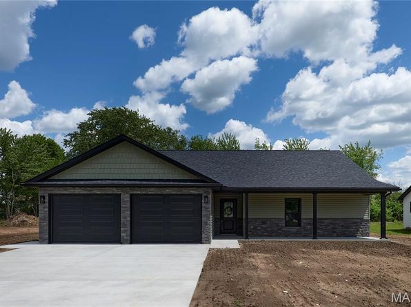
Crime & Safety Report for 905 W Maple St, Bowling Green, MO 63334

Review crime and safety information near 905 W Maple St, Bowling Green, MO 63334. HoodScore summarizes nearby reported incidents, registered sex offenders, and neighborhood safety indicators to help buyers and renters perform better location due diligence.

Generated At — 2026-07-25

Distance rings: 1 mi and 2 mi from the property.

PropertyIncidentsOffenders

Unlock the full safety report before making a decision about this neighborhood.

Full report contains 14 offenders within 5 miles and 102 crime incidents in the last 12 months.

14 Registered Sex Offenders within 5 miles Near 905 W Maple St, Bowling Green, MO 63334

14 Registered Offenders Nearby
5 Rape
8 Child Involved
1 Assault
6 Other
Photo Name / Age / Tags Arrest / Conviction Address Distance Risk
Offender photo

CHARLTON, MALLORIE MARIE

41 years old

Child Involved

Sex Cont W/inmate-emp Of Cor Fac

2024-12-20T10:58:19

8 JEFFERSON DR BOWLING GREEN, MO, 63334
0.6 High
Offender photo

CRANE, DONALD RAY

50 years old

16755 INDUSTRIAL PARK DR UNINC PIKE COUNTY, MO, 63334
1.9 Medium
Offender photo

CLINKENBEARD, HUNTER ADAMS

23 years old

Attempt Sexual Abuse - 1st Degree

2024-12-20T10:58:19

1603 US 61 BUS BOWLING GREEN, MO, 63334
1.2 Medium
Offender photo

DOYLE, STEPHEN GORDON

55 years old

Child Involved

Rapist

Stat Rape-1st Deg-pers Under 14

2024-12-20T10:58:19

Stat Sodomy-1st Deg-pers Und 14

2024-12-20T10:58:19

Statutory Sodomy-2nd Deg

2024-12-20T10:58:19

Statutory Rape-2nd Degre

2024-12-20T10:58:19

Statutory Sodomy-2nd Deg

2024-12-20T10:58:19

Statutory Rape-2nd Degre

2024-12-20T10:58:19

Statutory Rape-2nd Degre

2024-12-20T10:58:19

14856 PIKE 277 UNINC PIKE COUNTY, MO, 63353
4.7 Medium
Offender photo

DWYER, ROBERT EARL

48 years old

805 W LOCUST ST BOWLING GREEN, MO, 63334
0.4 High

102 Crime & Incidents in the Last 12 Months

102 Crime & Incidents by Severity
3 Severe
7 Medium
14 Low
78 Other
Crime Location (Approx.) Severity Description

Assault Report

07/16/2026 09:28 AM

Airport Rd, Bowling Green, MO 63334

Unknown

As discussed during the dispatch call, radio traffic reports a possible assault involving an unconscious person at Northeast Correctional Center near Airport Road in Bowling Green. Emergency units have been dispatched.

Medical Emergency

07/16/2026 08:46 AM

W Main St, Bowling Green, MO 63334

Unknown

As discussed during the dispatch call, emergency medical services are responding to breathing problems reported at a nursing home near Main Street in Bowling Green. Unit 1727 has been assigned to the incident.

Medical Emergency

07/16/2026 06:12 AM

S 20th St, Bowling Green, MO 63334

Unknown

As discussed during the dispatch call, a welfare check was conducted near 20th Street, (number withheld), in Bowling Green.

Medical Emergency

07/16/2026 12:31 AM

W Centennial Ave, Bowling Green, MO 63334

Unknown

As discussed during the dispatch call, police are dispatched for a psychiatric-related incident near West Centennial Avenue in Bowling Green. Unit 1727 responded to the location for a law request potentially involving mental health.

Fire

07/12/2026 10:55 AM

Bowling Green Municipal Airport, Municipal Airport, Outer Rd, Bowling Green, MO 63334

MEDIUM

As discussed during the dispatch call, dispatchers report a possible fire in Pike County, with units responding to the municipal airport. An Air Evac helicopter is en route with an estimated arrival in about sixteen minutes.

Nearby Schools

Schools within 2 miles of this property, nearest first.

SchoolDistance
BOWLING GREEN MIDDLE0.1 mi
BOWLING GREEN ELEM.0.1 mi
BOWLING GREEN HIGH0.2 mi
LILLIAN SCHAPER SCHOOL0.5 mi

Similar properties in Bowling Green

Other for-sale homes in Bowling Green within about 20% of this listing's price. Open a property for a HoodScore safety preview.

$259,900
3 bd | 2 ba | 1,388 sqft
1020 W Taylor St
Bowling Green, MO, 63334
View Safety Report

Frequently asked questions

Is 905 W Maple St in a low-crime area?

The current report summarizes crime-related incidents within 5 miles during the last 12 months. HoodScore compares these records with relevant benchmarks, but no report can guarantee future safety.

Why are traffic and medical calls shown separately from crime?

Traffic, medical and fire records are public-safety incidents but are not necessarily crimes. HoodScore separates them to avoid overstating the crime count.

How often is this HoodScore report updated?

The report displays its generated date. Update frequency varies by source and is explained in the HoodScore methodology.

How is the HoodScore calculated?

HoodScore combines nearby crime and offender data into a neighborhood safety score. Visit https://www.hoodscore.com/hoodscore-calculator.html to see how the calculation works.