
Crime & Safety Report for 2229 4th Ave S, Moorhead, MN 56560

Review crime and safety information near 2229 4th Ave S, Moorhead, MN 56560. HoodScore summarizes nearby reported incidents, registered sex offenders, and neighborhood safety indicators to help buyers and renters perform better location due diligence.

Generated At — 2026-07-25

Distance rings: 1 mi and 2 mi from the property.

PropertyIncidentsOffenders

Unlock the full safety report before making a decision about this neighborhood.

Full report contains 253 offenders within 5 miles and 297 crime incidents in the last 12 months.

253 Registered Sex Offenders within 5 miles Near 2229 4th Ave S, Moorhead, MN 56560

253 Registered Offenders Nearby
17 Rape
131 Child Involved
19 Assault
103 Other
Photo Name / Age / Tags Arrest / Conviction Address Distance Risk
Offender photo

UDEN, JAMES R

44 years old

Child Involved

3060 33RD ST 202 202 FARGO, ND, 58103
4.8 Medium
Offender photo

COLEMAN, DANNY FITZGERALD

59 years old

1000 BLOCK OF 18TH STREET SOUTH MOORHEAD, MN, 56560
0.6 High
Offender photo

MORIN, LEO LEONARD

60 years old

HOMELESS MOORHEAD, MN, 56560
1.1 Medium
Offender photo

HARMER, DAVID MARK

62 years old

VICINITY OF 18TH AVENUE NORTH MOORHEAD, MN, 56560
1.9 Medium
Offender photo

STORSTAD, TRAVIS DAVID

37 years old

Child Involved

2111 E MAIN AVE #109 WEST FARGO, ND, 58078
3.3 Medium

297 Crime & Incidents in the Last 12 Months

297 Crime & Incidents by Severity
58 Severe
23 Medium
27 Low
189 Other
Crime Location (Approx.) Severity Description

Medical Emergency

07/16/2026 07:17 PM

US-10, Moorhead, MN 56560

Unknown

As discussed during the dispatch call, a medical call reported an unconscious male at a bus shelter near Cash Wise Liquor on Highway 10 East in Moorhead. The patient was initially unresponsive but later found awake and breathing. Fire and EMS were canceled after police arrived on scene.

Medical Emergency

07/16/2026 09:35 AM

12th Ave S, Moorhead, MN 56560

Unknown

As discussed during the dispatch call, emergency services responded to a call for abdominal pain near 12th Avenue South.

Fire

07/14/2026 09:29 PM

50th Ave N, Moorhead, MN 56560

MEDIUM

As discussed during the dispatch call, fire crews responded to a sprinkler alarm at a building near 50th Avenue in Moorhead. Engine 1 investigated with nothing visible, while Engine 2 staged nearby as they were unable to locate any staff.

Fire

07/14/2026 09:18 PM

11th St N, Moorhead, MN 56560

MEDIUM

As discussed during the dispatch call, fire crews are responding to a reported general fire alarm with plant water flow activation at an industrial facility near 11th Street North in Moorhead, Minnesota. The alarm was apparently reported by an alarm company.

Fire

07/14/2026 09:10 PM

17th St S, Moorhead, MN 56560

MEDIUM

As discussed during the dispatch call, firefighters responded to a possible fire alarm activation at an apartment building near 17th Street South in Moorhead. Crews reported no smoke or flames and later indicated the alarm system was reset and no further response was needed.

Nearby Schools

Schools within 2 miles of this property, nearest first.

SchoolDistance
MOORHEAD HIGH SCHOOL0.1 mi
LAKES COUNTRY YOUTH EDUC SVCS0.9 mi
Robert Asp Elementary1.3 mi
West Central Academy-S1.3 mi
ELLEN HOPKINS ELEMENTARY1.4 mi
HORIZON MIDDLE SCHOOL1.5 mi
Moorhead High School Career Academy1.5 mi
Moorhead Online Secondary Academy1.5 mi
PROBSTFIELD CENTER FOR EDUCATION1.5 mi
Moorhead Online Elementary Academy1.5 mi
Probstfield Elementary1.5 mi
Moorhead ALC1.8 mi
Moorhead ALC: DGF Secondary1.8 mi
Moorhead ALC - Barnesville1.8 mi
West Central Academy-N1.8 mi

Similar properties in Moorhead

Other for-sale homes in Moorhead within about 20% of this listing's price. Open a property for a HoodScore safety preview.

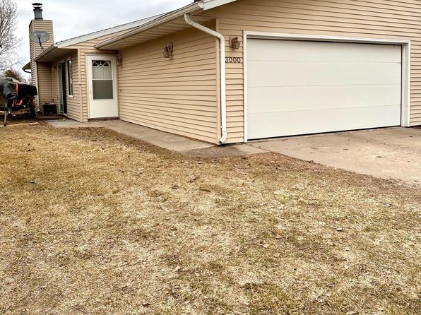
$185,000
2 bd | 1 ba | 1,152 sqft
3000 Covent Garden St S
Moorhead, MN, 56560
View Safety Report
$185,000
2 bd | 1 ba | 1,152 sqft
3000 Covent Garden St S
Moorhead, MN, 56562
View Safety Report

Frequently asked questions

Is 2229 4th Ave S in a low-crime area?

The current report summarizes crime-related incidents within 5 miles during the last 12 months. HoodScore compares these records with relevant benchmarks, but no report can guarantee future safety.

Why are traffic and medical calls shown separately from crime?

Traffic, medical and fire records are public-safety incidents but are not necessarily crimes. HoodScore separates them to avoid overstating the crime count.

How often is this HoodScore report updated?

The report displays its generated date. Update frequency varies by source and is explained in the HoodScore methodology.

How is the HoodScore calculated?

HoodScore combines nearby crime and offender data into a neighborhood safety score. Visit https://www.hoodscore.com/hoodscore-calculator.html to see how the calculation works.