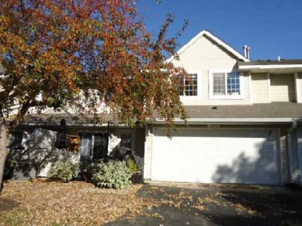
Crime & Safety Report for 12255 Zealand Ave N, Champlin, MN 55316

Review crime and safety information near 12255 Zealand Ave N, Champlin, MN 55316. HoodScore summarizes nearby reported incidents, registered sex offenders, and neighborhood safety indicators to help buyers and renters perform better location due diligence.

Generated At — 2026-07-25
Distance rings: 1 mi and 2 mi from the property.

PropertyIncidentsOffenders

Unlock the full safety report before making a decision about this neighborhood.

Full report contains 8 offenders within 5 miles and 3625 crime incidents in the last 12 months.

8 Registered Sex Offenders within 5 miles Near 12255 Zealand Ave N, Champlin, MN 55316

8 Registered Offenders Nearby
0 Rape
0 Child Involved
0 Assault
8 Other
Photo Name / Age / Tags Arrest / Conviction Address Distance Risk
Offender photo

MASTENBROOK, DONALD ABE

67 years old

750.520E1G - CRIMINAL SEXUAL CONDUCT 4TH DEGREE (INCEST)

2024-10-06T07:43:22

8300 96TH AVE N/A, MI
3.6 Medium
Offender photo

COON, TIMOTHY DAWKINS

38 years old

5500 BLOCK OF 146TH AVENUE NORTHWEST RAMSEY, MN, 55303
4.2 Medium
Offender photo

LEVERCOM, KENNETH RAY

39 years old

900 BLOCK OF NORTH STREET ANOKA, MN, 55303
2.1 Medium
Offender photo

REYNOLDS, WILLIE EDD

60 years old

VICINITY OF OXBOROUGH GARDENS BROOKLYN PARK, MN, 55443
4.8 Medium
Offender photo

WALTER, CHRISTOPHER DEE

42 years old

9900 BLOCK OF CHESTNUT AVENUE NORTH BROOKLYN PARK, MN, 55443
4.3 Medium

3625 Crime & Incidents in the Last 12 Months

3625 Crime & Incidents by Severity
410 Severe
476 Medium
516 Low
2223 Other
Crime Location (Approx.) Severity Description

Other Incidents

07/16/2026 09:21 PM

124th Ave NW, Coon Rapids, MN 55433

Unknown

As discussed during the dispatch call, staff reported a possible illegal dumping incident involving a white SUV that allegedly threw garbage near a retail area on 124th Avenue Northwest before leaving toward nearby businesses.

Traffic

07/16/2026 09:03 PM

Ferry St, Champlin, MN 55316

LOW

As discussed during the dispatch call, officers were asked to assist Champlin police with a possible vehicle pursuit involving a bronze Subaru coupe near Highway 10 and Ferry Street.

Suspicious Activity

07/16/2026 09:02 PM

Ferry St & Benton St, Anoka, MN 55303

MEDIUM

As discussed during the dispatch call, officers in Anoka are coordinating a search for a suspect who fled from a vehicle and then ran on foot near the Ferry Street bridge area by the river, with a perimeter reportedly set around Ferry Street, Benton Street, and the Highway 169 bridge. A separate medical transport for an adult male with anxiety and high blood pressure is also mentioned in the same radio traffic. Another unrelated call references a triple alarm at a location on Birch Street.

Domestic Dispute

07/16/2026 08:52 PM

Harrison St, Anoka, MN 55303

Unknown

As discussed during the dispatch call, officers were dispatched to a possible domestic disturbance outside an apartment building near Harrison Street, where a caller reported people speaking Spanish and the sound of objects being thrown.

Suspicious Activity

07/16/2026 08:41 PM

North St, Anoka, MN 55303

MEDIUM

As discussed during the dispatch call, dispatch reported a possible suspicious white Ford passenger vehicle near North St in Anoka, with two males last seen leaving toward the county area.

Nearby Schools

Schools within 2 miles of this property, nearest first.

SchoolDistance
Modern Montessori Charter School1.0 mi
Lincoln Elementary School for Arts1.0 mi
ANOKA MIDDLE SCHOOL FOR THE ARTS1.1 mi
Anoka-Hennepin Regional High School1.4 mi
EARLY CHILDHOOD/SPECIAL EDUCATION1.4 mi
Elementary Virtual School1.6 mi
FRANKLIN ELEMENTARY1.6 mi
Innovation Sci & Tech Elementary1.8 mi
Innovation Sci & Tech Middle1.8 mi

Frequently asked questions

Is 12255 Zealand Ave N in a low-crime area?

The current report summarizes crime-related incidents within 5 miles during the last 12 months. HoodScore compares these records with relevant benchmarks, but no report can guarantee future safety.

Why are traffic and medical calls shown separately from crime?

Traffic, medical and fire records are public-safety incidents but are not necessarily crimes. HoodScore separates them to avoid overstating the crime count.

How often is this HoodScore report updated?

The report displays its generated date. Update frequency varies by source and is explained in the HoodScore methodology.

How is the HoodScore calculated?

HoodScore combines nearby crime and offender data into a neighborhood safety score. Visit https://www.hoodscore.com/hoodscore-calculator.html to see how the calculation works.