Crime & Safety Report for 1955 Forest Mead Dr, Sterling Heights, MI 48314

Review crime and safety information near 1955 Forest Mead Dr, Sterling Heights, MI 48314. HoodScore summarizes nearby reported incidents, registered sex offenders, and neighborhood safety indicators to help buyers and renters perform better location due diligence.

Generated At — 2026-07-25
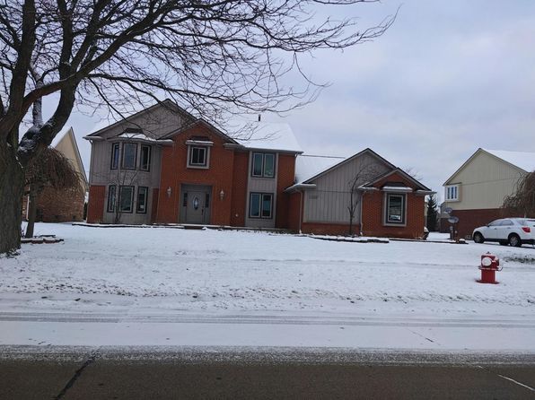
Distance rings: 1 mi and 2 mi from the property.

PropertyIncidentsOffenders

Unlock the full safety report before making a decision about this neighborhood.

Full report contains 358 offenders within 5 miles and 2302 crime incidents in the last 12 months.

358 Registered Sex Offenders within 5 miles Near 1955 Forest Mead Dr, Sterling Heights, MI 48314

358 Registered Offenders Nearby
7 Rape
64 Child Involved
37 Assault
260 Other
Photo Name / Age / Tags Arrest / Conviction Address Distance Risk
Offender photo

PAS, JOSEPH PATRICK

65 years old

Rapist

Violent

AGGRAVATED CRIMINAL SEXUAL ABUSE/VICTIM 13-16

2024-10-25T06:34:59

12445 W GREENWAY DR STERLING HEIGHTS, MI, 62801
3.4 Medium
Offender photo

SRBINOSKI, BLAGOJA

45 years old

6633 18 MILE RD 31 STERLING HEIGHTS, MI, 48314
2.4 Medium
Offender photo

SLUSHER, GIDEON CHARLES

42 years old

Violent

1923 RING DR TROY, MI, 48083
4.1 Medium
Offender photo

STOUT, KEVIN PHILIP

39 years old

5965 WALL STREET STERLING HEIGHTS, MI, 48312
3.1 Medium
Offender photo

ALI, DAHOOD KAHLID

55 years old

Child Involved

7630 19 MILE RD STERLING HEIGHTS, MI, 48314
2.8 Medium

2302 Crime & Incidents in the Last 12 Months

2302 Crime & Incidents by Severity
254 Severe
286 Medium
509 Low
1253 Other
Crime Location (Approx.) Severity Description

Suspicious Activity

07/16/2026 09:22 PM

Woodmont Dr, Sterling Heights, MI 48310

MEDIUM

As discussed during the dispatch call, officers are dispatched to check a suspicious vehicle near Woodmont Drive by the dead end in Sterling Heights. The caller reported the vehicle had been there for about 20 minutes and someone got in but did not appear to get back out.

Fire

07/16/2026 09:19 PM

Orban Dr, Sterling Heights, MI 48310

MEDIUM

As discussed during the dispatch call, firefighters were dispatched to a reported residential fire alarm at a home on Orbin Drive in Sterling Heights, with no smoke or flames observed.

Medical Emergency

07/16/2026 08:48 PM

Lucerne Dr, Sterling Heights, MI 48310

Unknown

As discussed during the dispatch call, emergency crews were dispatched to a possible medical emergency involving an 18-year-old man who reportedly passed out, struck his head, and was not responding at a residence near Lucerne Drive in Sterling Heights.

Traffic

07/16/2026 08:41 PM

Mile Rd & Van Dyke Ave, Sterling Heights, MI 48314

LOW

As discussed during the dispatch call, officers are responding to a report of a suspected hit-and-run vehicle detected by a license plate camera near 19 Mile Road and Van Dyke Avenue. The vehicle is described as a gray Hyundai Tucson with front left damage, and officers are heading to the area to look for it.

Medical Emergency

07/16/2026 08:34 PM

Van Dyke Ave, Sterling Heights, MI 48312

Unknown

As discussed during the dispatch call, a female is having possible complications from recent surgery near Van Dyke Avenue. Sterling Squad 1 was dispatched to assist police at the location.

Nearby Schools

Schools within 2 miles of this property, nearest first.

SchoolDistance
Wass Elementary School0.7 mi
Burr Elementary School1.1 mi
Frank Jeannette Jr High School1.2 mi
Hill Elementary School1.3 mi
Larson Middle School1.3 mi
Schuchard Elementary School1.6 mi
Troy Union Elementary School1.7 mi
Athens High School1.9 mi

Frequently asked questions

Is 1955 Forest Mead Dr in a low-crime area?

The current report summarizes crime-related incidents within 5 miles during the last 12 months. HoodScore compares these records with relevant benchmarks, but no report can guarantee future safety.

Why are traffic and medical calls shown separately from crime?

Traffic, medical and fire records are public-safety incidents but are not necessarily crimes. HoodScore separates them to avoid overstating the crime count.

How often is this HoodScore report updated?

The report displays its generated date. Update frequency varies by source and is explained in the HoodScore methodology.

How is the HoodScore calculated?

HoodScore combines nearby crime and offender data into a neighborhood safety score. Visit https://www.hoodscore.com/hoodscore-calculator.html to see how the calculation works.