Crime & Safety Report for McKay Dr, Knoxville, IA

Review crime and safety information near McKay Dr, Knoxville, IA. HoodScore summarizes nearby reported incidents, registered sex offenders, and neighborhood safety indicators to help buyers and renters perform better location due diligence.

Generated At — 2026-07-25

Distance rings: 1 mi and 2 mi from the property.

PropertyIncidentsOffenders

Unlock the full safety report before making a decision about this neighborhood.

Full report contains 22 offenders within 5 miles and 293 crime incidents in the last 12 months.

22 Registered Sex Offenders within 5 miles Near McKay Dr, Knoxville, IA

22 Registered Offenders Nearby
3 Rape
9 Child Involved
3 Assault
9 Other
Photo Name / Age / Tags Arrest / Conviction Address Distance Risk
Offender photo

BOUNDS, BRADLEY E

49 years old

Rapist

Violent

AGGRAVATED CRIMINAL SEX ABUSE/VICTIM 13-18

2024-10-25T06:34:59

1293 ILLINOIS DRIVE KNOXVILLE, IA, 50138
4.7 Medium
Offender photo

CHURCH, ROBERT DANIEL

37 years old

Violent

709,11 Assault with intent to commit sexual abuse

2024-09-03T13:50:15

314 W WASHINGTON ST KNOXVILLE, IA, 50138
0.9 High
Offender photo

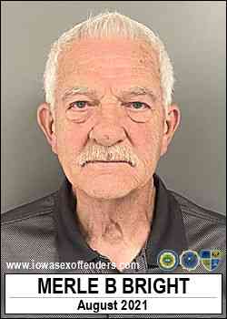
BRIGHT, MERLE BUD

78 years old

709,9 Indecent exposure

2024-09-03T13:50:15

1314 N DEPOT KNOXVILLE, IA, 50138
1 Medium
Offender photo

DAVIS, TERRY MICHAEL

50 years old

Child Involved

709,4 Sexual abuse 3rd degree

2024-09-03T13:50:15

709,4 Sexual abuse 3rd degree

2024-09-03T13:50:15

Non-Iowa Conviction - Possession of child pornography

2024-09-03T13:50:15

175 LAKEVIEW DR KNOXVILLE, IA, 50138
4.7 Medium
Offender photo

HECK, JIMMY DWAYNE

65 years old

709,4 Sexual abuse 3rd degree

2024-09-03T13:50:15

709,4 Sexual abuse 3rd degree

2024-09-03T13:50:15

101 HOLMES DR KNOXVILLE, IA, 50138
4.9 Medium

293 Crime & Incidents in the Last 12 Months

293 Crime & Incidents by Severity
26 Severe
37 Medium
75 Low
155 Other
Crime Location (Approx.) Severity Description

Assault Report

07/16/2026 09:49 PM

W Pleasant St, Knoxville, IA 50138

Unknown

As discussed during the dispatch call, officers in Knoxville responded to a possible assault and disturbance at a location on North Pleasant Street. A highly intoxicated man was reported to be assaulting people, with no injuries reported. He was later contacted by officers outside near Pleasant Street and Fremont.

Traffic

07/16/2026 06:32 PM

W Howard St & S Lincoln St, Knoxville, IA 50138

LOW

As discussed during the dispatch call, officers conducted a traffic stop near Lincoln Street and Howard Street involving a white Dodge Stratus with its registration reportedly valid through July 2026.

Traffic

07/16/2026 03:50 PM

N 2nd St & Douglas St, Knoxville, IA 50138

LOW

As discussed during the dispatch call, dispatch received a report of possible reckless driving and street racing near Second Street and Douglas Street by a local park, involving mopeds, motorcycles, and a white lifted truck that were seen speeding and not paying attention before leaving the area.

Suspicious Animal

07/16/2026 02:37 PM

W Washington St, Knoxville, IA 50138

Unknown

As discussed during the dispatch call, officers discussed an earlier report of an aggressive loose dog in the backyards between two homes on West Washington Street. A caller at a nearby residence reported a brindle pit bull, and it was later reported near a camper at another nearby home, apparently loose and chasing cars. Units were coordinated to check the area and respond to other possible disturbances mentioned over the radio.

Traffic

07/16/2026 12:50 PM

E Robinson St, Knoxville, IA 50138

LOW

As discussed during the dispatch call, officers received a parking complaint about a black car with front-end damage that had reportedly been left in front of a bar near East Robinson Street since last Friday.

Nearby Schools

Schools within 2 miles of this property, nearest first.

SchoolDistance
Knoxville High School0.2 mi
Knoxville Middle School0.3 mi
West Elementary0.4 mi
Northstar Elementary School1.5 mi

Frequently asked questions

Is McKay Dr in a low-crime area?

The current report summarizes crime-related incidents within 5 miles during the last 12 months. HoodScore compares these records with relevant benchmarks, but no report can guarantee future safety.

Why are traffic and medical calls shown separately from crime?

Traffic, medical and fire records are public-safety incidents but are not necessarily crimes. HoodScore separates them to avoid overstating the crime count.

How often is this HoodScore report updated?

The report displays its generated date. Update frequency varies by source and is explained in the HoodScore methodology.

How is the HoodScore calculated?

HoodScore combines nearby crime and offender data into a neighborhood safety score. Visit https://www.hoodscore.com/hoodscore-calculator.html to see how the calculation works.