Crime & Safety Report for 2002 NW 9th St, Ankeny, IA 50023

Review crime and safety information near 2002 NW 9th St, Ankeny, IA 50023. HoodScore summarizes nearby reported incidents, registered sex offenders, and neighborhood safety indicators to help buyers and renters perform better location due diligence.

Generated At — 2026-07-25

Distance rings: 1 mi and 2 mi from the property.

PropertyIncidentsOffenders

Unlock the full safety report before making a decision about this neighborhood.

Full report contains 48 offenders within 5 miles and 233 crime incidents in the last 12 months.

48 Registered Sex Offenders within 5 miles Near 2002 NW 9th St, Ankeny, IA 50023

48 Registered Offenders Nearby
1 Rape
24 Child Involved
14 Assault
12 Other
Photo Name / Age / Tags Arrest / Conviction Address Distance Risk
Offender photo

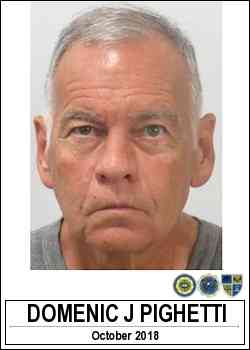
PIGHETTI, DOMENIC JOHN

80 years old

Child Involved

3853 NW 92ND PL POLK CITY, IA, 50226
2.4 Medium
Offender photo

SAUKKO, JAMES ERNEST

58 years old

Child Involved

13232 NW 30TH POLK CITY, IA, 50226
4.7 Medium
Offender photo

WOODARD, GLENN DALE JR

62 years old

Rapist

5539 NW 118TH AVE POLK CITY, IA, 50226
4.3 Medium
Offender photo

BONISH, DAVID ALAN

37 years old

Child Involved

728,12 Sexual exploitation minor

2024-09-03T13:50:15

Non-Iowa Conviction - Receipt or possession of child pornography

2024-09-03T13:50:15

1402 NE CRESTMOOR PL ANKENY, IA, 50021
1.6 Medium
Offender photo

CLARK, BLAKE BOWMAN

32 years old

Child Involved

710,10 Enticing a minor

2024-09-03T13:50:15

708,7 Harassment

2024-09-03T13:50:15

324 NE WHITETAIL DR ANKENY, IA, 50021
4.1 Medium

233 Crime & Incidents in the Last 12 Months

233 Crime & Incidents by Severity
33 Severe
15 Medium
31 Low
154 Other
Crime Location (Approx.) Severity Description

Medical Emergency

07/16/2026 01:23 PM

SE Convenience Blvd, Ankeny, IA 50021

Unknown

As discussed during the dispatch call, a medical emergency involving diabetic problems was reported near Southeast Convenience Boulevard at Casey's Corporate Offices. Emergency units responded.

Public Assist

07/16/2026 08:00 AM

SE Rio Dr, Ankeny, IA 50021

LOW

As discussed during the dispatch call, engine 121 was dispatched for a possible public assistance call at an apartment unit on Southeast Rio Drive in Ankeny.

Public Assist

07/16/2026 03:04 AM

SW Franklin Ln, Ankeny, IA 50023

LOW

As discussed during the dispatch call, engine 121 was dispatched for a public assist at a residence near Southwest Franklin Lane, between Southwest 31st Street and Southwest 2nd Street in Ankeny, Iowa.

Traffic

07/14/2026 07:14 PM

S Ankeny Blvd & SW Oralabor Rd, Ankeny, IA 50021

LOW

As discussed during the dispatch call, officers in the Ankeny area were involved in a high speed vehicle pursuit that moved toward Des Moines. The fleeing driver reportedly reached around 90 miles per hour and nearly hit multiple vehicles before officers used tire spikes and a PIT maneuver to stop the vehicle. The driver was taken into custody, and medics were requested for the same person after a Taser deployment. Other radio traffic referenced a separate car versus deer crash with a fluid spill and a separate disturbance involving a man reportedly threatening people with a knife at a public location.

Traffic

07/14/2026 07:11 PM

S Ankeny Blvd & SW Oralabor Rd, Ankeny, IA 50021

LOW

As discussed during the dispatch call, officers are coordinating by radio to locate a silver Oldsmobile minivan that was last reported southbound on Ankeny Boulevard near Oralabor Road in Ankeny. The incident appears to involve an ongoing vehicle pursuit and arrangements for a tow truck.

Nearby Schools

Schools within 2 miles of this property, nearest first.

SchoolDistance
Westwood Elementary School0.6 mi
Prairie Ridge Middle School0.7 mi
Ankeny Centennial High School0.8 mi
Northwest Elementary School0.8 mi
Terrace Learning Center1.2 mi
Ashland Ridge Elementary1.2 mi
Parkview Middle School1.3 mi
Northview Middle School1.3 mi
Southview Middle School1.6 mi
Rock Creek Elementary1.6 mi
Ankeny High School1.8 mi
Prairie Trail Elementary1.9 mi
Northeast Elementary2.0 mi

Frequently asked questions

Is 2002 NW 9th St in a low-crime area?

The current report summarizes crime-related incidents within 5 miles during the last 12 months. HoodScore compares these records with relevant benchmarks, but no report can guarantee future safety.

Why are traffic and medical calls shown separately from crime?

Traffic, medical and fire records are public-safety incidents but are not necessarily crimes. HoodScore separates them to avoid overstating the crime count.

How often is this HoodScore report updated?

The report displays its generated date. Update frequency varies by source and is explained in the HoodScore methodology.

How is the HoodScore calculated?

HoodScore combines nearby crime and offender data into a neighborhood safety score. Visit https://www.hoodscore.com/hoodscore-calculator.html to see how the calculation works.