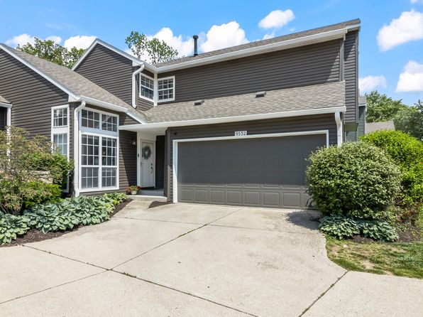
Crime & Safety Report for 9049 Lisering Cir, Indianapolis, IN 46256

Review crime and safety information near 9049 Lisering Cir, Indianapolis, IN 46256. HoodScore summarizes nearby reported incidents, registered sex offenders, and neighborhood safety indicators to help buyers and renters perform better location due diligence.

Generated At — 2026-07-26

Distance rings: 1 mi and 2 mi from the property.

PropertyIncidentsOffenders

Unlock the full safety report before making a decision about this neighborhood.

Full report contains 82 offenders within 5 miles and 4109 crime incidents in the last 12 months.

82 Registered Sex Offenders within 5 miles Near 9049 Lisering Cir, Indianapolis, IN 46256

82 Registered Offenders Nearby
6 Rape
44 Child Involved
15 Assault
21 Other
Photo Name / Age / Tags Arrest / Conviction Address Distance Risk
Offender photo

BAZZELL, MARK ALLEN

51 years old

Violent

6886 HILLSDALE CT INDIANAPOLIS, IL, 46250
2 Medium
Offender photo

HINDS, ALONA JOYCE ANN

39 years old

Violent

10118 PLUMTREE DR INDIANAPOLIS, IN, 46235
5 Medium
Offender photo

RICKENBACH, HUNTER REED

30 years old

Child Involved

Violent

12115 OLD ORCHARD DR INDIANAPOLIS, IN, 46236
4.7 Medium
Offender photo

SKIRVIN, ANTHONY LEE

47 years old

Child Involved

9700 HAGUE RD INDIANAPOLIS, IN, 46256
0.9 High
Offender photo

CUMMINS, ALLEN MICHAEL

34 years old

Violent

4930 EMCO DR INDIANAPOLIS, IN, 46220
4.5 Medium

4109 Crime & Incidents in the Last 12 Months

4109 Crime & Incidents by Severity
516 Severe
435 Medium
637 Low
2521 Other
Crime Location (Approx.) Severity Description

Medical Emergency

07/16/2026 10:09 PM

Mercyside Ct, Indianapolis, IN 46236

Unknown

As discussed during the dispatch call, a possible allergic reaction medical emergency occurred near Mercyside Court. Emergency units responded to the scene.

Road Closure

07/16/2026 09:30 PM

82nd St, Indianapolis, IN 46250

Unknown

As discussed during the dispatch call, radio traffic reports that westbound 82nd Street is closed near the I-69 bridge due to a possible road hazard or obstruction.

Medical Emergency

07/16/2026 09:22 PM

Kent Ave, Indianapolis, IN 46216

Unknown

As discussed during the dispatch call, an ambulance was dispatched to a mental or emotional complaint near Kent Avenue.

Fire

07/16/2026 09:22 PM

Sunnyside Rd, Indianapolis, IN 46236

MEDIUM

As discussed during the dispatch call, fire units were dispatched to a possible building alarm near Sunnyside Road in Lawrence.

Substance Use

07/16/2026 09:21 PM

E 81st St & Allisonville Rd, Indianapolis, IN 46250

Unknown

As discussed during the dispatch call, officers received a report of a possibly intoxicated driver in a white pickup truck speeding and swerving near East 81st Street and Allisonville Road, last seen heading toward a nearby Trader Joe’s store.

Nearby Schools

Schools within 2 miles of this property, nearest first.

SchoolDistance
Mary Evelyn Castle Elementary Sch0.9 mi
Lantern Road Elementary School1.6 mi
Lawrence North High School1.7 mi
Dynamic Minds Academy1.7 mi

Similar properties in Indianapolis

Other for-sale homes in Indianapolis within about 20% of this listing's price. Open a property for a HoodScore safety preview.

$220,000
2 bd | 2 ba | 1,295 sqft
5924 Highgate Cir E
Indianapolis, IN, 46250
View Safety Report
$215,000
2 bd | 2 ba | 1,530 sqft
9415 Timber View Dr
Indianapolis, IN, 46250
View Safety Report
$222,500
2 bd | 3 ba | 1,612 sqft
7171 Long Boat Dr
Indianapolis, IN, 46250
View Safety Report
$225,000
5 bd | 4 ba | 2,854 sqft
9607 Piper Lake Dr
Indianapolis, IN, 46239
View Safety Report
$225,000
2 bd | 3 ba | 1,391 sqft
9479 Bridgewater Cir
Indianapolis, IN, 46250
View Safety Report
$227,900
3 bd | 2 ba | 1,064 sqft
9010 E Raymond St
Indianapolis, IN, 46239
View Safety Report
$232,000
2 bd | 3 ba | 1,373 sqft
6558 Wandsworth Cir
Indianapolis, IN, 46250
View Safety Report

Frequently asked questions

Is 9049 Lisering Cir in a low-crime area?

The current report summarizes crime-related incidents within 5 miles during the last 12 months. HoodScore compares these records with relevant benchmarks, but no report can guarantee future safety.

Why are traffic and medical calls shown separately from crime?

Traffic, medical and fire records are public-safety incidents but are not necessarily crimes. HoodScore separates them to avoid overstating the crime count.

How often is this HoodScore report updated?

The report displays its generated date. Update frequency varies by source and is explained in the HoodScore methodology.

How is the HoodScore calculated?

HoodScore combines nearby crime and offender data into a neighborhood safety score. Visit https://www.hoodscore.com/hoodscore-calculator.html to see how the calculation works.