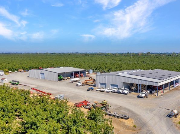
Crime & Safety Report for 45496 County Road 35, Davis, CA 95618

Review crime and safety information near 45496 County Road 35, Davis, CA 95618. HoodScore summarizes nearby reported incidents, registered sex offenders, and neighborhood safety indicators to help buyers and renters perform better location due diligence.

Generated At — 2026-07-25
Distance rings: 1 mi and 2 mi from the property.

PropertyIncidentsOffenders

Unlock the full safety report before making a decision about this neighborhood.

Full report contains 7 offenders within 5 miles and 916 crime incidents in the last 12 months.

7 Registered Sex Offenders within 5 miles Near 45496 County Road 35, Davis, CA 95618

7 Registered Offenders Nearby
2 Rape
5 Child Involved
1 Assault
1 Other
Photo Name / Age / Tags Arrest / Conviction Address Distance Risk
Offender photo

CAI, PING

55 years old

Child Involved

LEWD OR LASCIVIOUS ACTS WITH A CHILD UNDER 14 YEARS OF AGE

2025-08-24T09:10:53

3134 NANTUCKET DAVIS, CA, 95618
3.2 Medium
Offender photo

MERRILL, DAVID WARNER

55 years old

REQUIRED TO REGISTER BASED ON A NON-CALIFORNIA SEX OFFENSE

2025-08-24T09:38:46

Not Provided DAVIS, CA, 95618
2.7 Medium
Offender photo

BROWNLEE, JOSEPH DANIEL

41 years old

Child Involved

LEWD OR LASCIVIOUS ACTS WITH A CHILD 14 OR 15 YEARS OF AGE AND OFFENDER 10 OR MORE YEARS OLDER THAN VICTIM

2025-08-24T09:10:53

GO TO ARRANGED MEETING WITH MINOR WITH INTENT TO COMMIT A SPECIFIED SEX OFFENSE

2025-08-24T09:10:53

931 CHESTNUT LN DAVIS, CA, 95616
4.5 Medium
Offender photo

DAVIS, COREY LYNN

46 years old

Rapist

RAPE OF A DRUGGED/INTOXICATED VICTIM

2025-08-24T09:10:53

1215 SPRUCE LN DAVIS, CA, 95616
4.7 Medium
Offender photo

PAULSON, JOHN CLARENCE

65 years old

Child Involved

INDECENT EXPOSURE

2025-08-24T09:10:55

PRIOR CODE: LEWD OR LASCIVIOUS ACTS WITH A CHILD UNDER 14 YEARS OF AGE BY FORCE OR FEAR

2025-08-24T09:10:55

INDECENT EXPOSURE WITH PRIOR CONVICTION FOR THIS OFFENSE

2025-08-24T09:10:55

50 BROKEN CIR DAVIS, CA, 95618
4.1 Medium

916 Crime & Incidents in the Last 12 Months

916 Crime & Incidents by Severity
112 Severe
128 Medium
230 Low
446 Other
Crime Location (Approx.) Severity Description

Traffic

07/16/2026 09:44 PM

5th St & G St, Davis, CA 95616

LOW

As discussed during the dispatch call, officers conduct a traffic stop near Fifth Street and G Street in Davis after clarifying the correct intersection and a vehicle license plate.

Suspicious Person

07/16/2026 09:32 PM

Chiles Rd, Davis, CA 95616

Unknown

As discussed during the dispatch call, officers responded to a possible suspicious person and vehicle at a fast-food restaurant in Davis, where an unoccupied car was found in the parking lot and the driver was believed to be inside the business. Staff were reportedly withholding property from the person, and officers noted a possible battery-related offense and requested restricted radio traffic at the scene.

Public Assistance

07/16/2026 08:44 PM

Javier Pl, Davis, CA 95618

LOW

As discussed during the dispatch call, engine 31 is dispatched to a public assistance call at a residence on Aubier Place in Davis.

Break-In

07/16/2026 08:10 PM

Mace Ranch, Davis, CA 95618

Unknown

As discussed during the dispatch call, officers responded to a possible burglary alarm at a corporate center in Davis. The alarm involved door sensors at two entries and was later reported restored, with cleaning staff or a custodian believed to be responsible for the activation.

Suspicious Activity

07/16/2026 07:40 PM

5th St & G St, Davis, CA 95616

MEDIUM

As discussed during the dispatch call, officers responded to a domestic-related security alarm, possibly involving utility equipment, with alerts reported near 5th and G streets and a gate code requested for access.

Frequently asked questions

Is 45496 County Road 35 in a low-crime area?

The current report summarizes crime-related incidents within 5 miles during the last 12 months. HoodScore compares these records with relevant benchmarks, but no report can guarantee future safety.

Why are traffic and medical calls shown separately from crime?

Traffic, medical and fire records are public-safety incidents but are not necessarily crimes. HoodScore separates them to avoid overstating the crime count.

How often is this HoodScore report updated?

The report displays its generated date. Update frequency varies by source and is explained in the HoodScore methodology.

How is the HoodScore calculated?

HoodScore combines nearby crime and offender data into a neighborhood safety score. Visit https://www.hoodscore.com/hoodscore-calculator.html to see how the calculation works.