Crime & Safety Report for 289 Reef Point Way Unit 3, Oceanside, CA 92058

Review crime and safety information near 289 Reef Point Way Unit 3, Oceanside, CA 92058. HoodScore summarizes nearby reported incidents, registered sex offenders, and neighborhood safety indicators to help buyers and renters perform better location due diligence.

Generated At — 2026-07-25
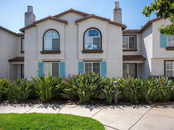
Distance rings: 1 mi and 2 mi from the property.

PropertyIncidentsOffenders

Unlock the full safety report before making a decision about this neighborhood.

Full report contains 123 offenders within 5 miles and 1891 crime incidents in the last 12 months.

123 Registered Sex Offenders within 5 miles Near 289 Reef Point Way Unit 3, Oceanside, CA 92058

123 Registered Offenders Nearby
13 Rape
95 Child Involved
17 Assault
15 Other
Photo Name / Age / Tags Arrest / Conviction Address Distance Risk
Offender photo

BROWN, ANDREW LAWRENCE

36 years old

Not Provided OCEANSIDE, CA, 92056
3 Medium
Offender photo

COTA, OBED JESE

30 years old

Child Involved

Not Provided OCEANSIDE, CA, 92056
3 Medium
Offender photo

OTT, ERIC

52 years old

Not Provided OCEANSIDE, CA, 92057
2.7 Medium
Offender photo

PAGDILAO, ANTHONY CHRISTOPHER

58 years old

Child Involved

Not Provided OCEANSIDE, CA, 92057
2.7 Medium
Offender photo

PECBOT, MAJOR ARTHUR

67 years old

Child Involved

Not Provided OCEANSIDE, CA, 92057
2.7 Medium

1891 Crime & Incidents in the Last 12 Months

1891 Crime & Incidents by Severity
118 Severe
44 Medium
321 Low
1408 Other
Crime Location (Approx.) Severity Description

Medical Emergency

07/16/2026 10:10 PM

N Melrose Dr Spc 6, Vista, CA 92083

Unknown

As discussed during the dispatch call, emergency crews were dispatched to a mobile home park in Vista for a possible heart-related medical problem involving a patient at a specific space within the park.

Substance Use

07/16/2026 10:01 PM

Vista Way, Oceanside, CA 92056

Unknown

As discussed during the dispatch call, medical crews report a 40-year-old man who appears intoxicated after an apparent fall on a sidewalk, with head pain, a cut lip, a bruised eye, and controlled bleeding, being transported to a hospital with a short estimated arrival time.

Medical Emergency

07/16/2026 09:35 PM

San Jose St & Capistrano Dr, Oceanside, CA 92058

Unknown

As discussed during the dispatch call, emergency crews respond to a possible hemorrhage near Capistrano Drive and San Jose Street in Oceanside.

Traffic

07/16/2026 09:28 PM

I-5, Oceanside, CA

LOW

As discussed during the dispatch call, officers conducted a traffic stop on a yellow vehicle on Cass Street just west of Interstate 5. A records check on the driver reportedly showed a valid license with no prior record.

Traffic

07/16/2026 09:21 PM

Cassidy St, Oceanside, CA 92054

LOW

As discussed during the dispatch call, officers followed a suspected vehicle from the area of Harvard Drive and conducted a traffic stop near Cassidy Street and Oceanside Boulevard in Oceanside, with radio reports later indicating the situation was code 4 on the southbound I-5 Cassidy off-ramp.

Nearby Schools

Schools within 2 miles of this property, nearest first.

SchoolDistance
Scholarship Prep - Oceanside0.5 mi
Louise Foussat Elementary0.5 mi
Nichols Elementary0.7 mi
Pablo Tac School of the Arts0.9 mi
El Camino High1.0 mi
Martin Luther King Jr. Middle1.5 mi
Cesar Chavez Middle1.6 mi
Pacific View Charter1.6 mi
Ivey Ranch Elementary1.7 mi
Libby Elementary1.8 mi
Reynolds Elementary1.9 mi

Similar properties in Oceanside

Other for-sale homes in Oceanside within about 20% of this listing's price. Open a property for a HoodScore safety preview.

$664,000
3 bd | 3 ba | 1,346 sqft
4002 Craven Rd Unit 4
Oceanside, CA, 92057
View Safety Report
$650,000
3 bd | 3 ba | 1,471 sqft
625 Sumner Way Unit 4
Oceanside, CA, 92058
View Safety Report
$650,000
1 bd | 1 ba | 756 sqft
503 N Tremont St APT G
Oceanside, CA, 92054
View Safety Report
$649,900
1 bd | 1 ba | 760 sqft
999 N Pacific St Unit B209
Oceanside, CA, 92054
View Safety Report

Frequently asked questions

Is 289 Reef Point Way Unit 3 in a low-crime area?

The current report summarizes crime-related incidents within 5 miles during the last 12 months. HoodScore compares these records with relevant benchmarks, but no report can guarantee future safety.

Why are traffic and medical calls shown separately from crime?

Traffic, medical and fire records are public-safety incidents but are not necessarily crimes. HoodScore separates them to avoid overstating the crime count.

How often is this HoodScore report updated?

The report displays its generated date. Update frequency varies by source and is explained in the HoodScore methodology.

How is the HoodScore calculated?

HoodScore combines nearby crime and offender data into a neighborhood safety score. Visit https://www.hoodscore.com/hoodscore-calculator.html to see how the calculation works.