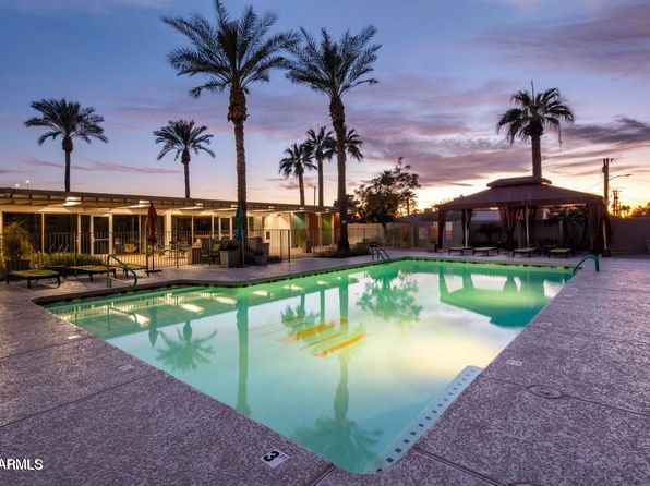

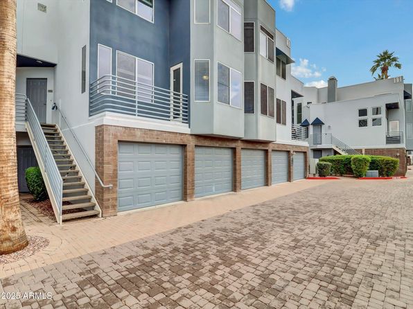
Crime & Safety Report for 3242 E CAMELBACK Road #104, Phoenix, AZ 85018

Review crime and safety information near 3242 E CAMELBACK Road #104, Phoenix, AZ 85018. HoodScore summarizes nearby reported incidents, registered sex offenders, and neighborhood safety indicators to help buyers and renters perform better location due diligence.

Generated At — 2026-07-26

Distance rings: 1 mi and 2 mi from the property.

PropertyIncidentsOffenders

Unlock the full safety report before making a decision about this neighborhood.

Full report contains 500 offenders within 5 miles and 11715 crime incidents in the last 12 months.

500 Registered Sex Offenders within 5 miles Near 3242 E CAMELBACK Road #104, Phoenix, AZ 85018

500 Registered Offenders Nearby
24 Rape
331 Child Involved
80 Assault
89 Other
Photo Name / Age / Tags Arrest / Conviction Address Distance Risk
Offender photo

ALLEN, CHRISTOPHER MONTGOMERY

60 years old

Child Involved

2218 E TAYLOR ST PHOENIX, AZ, 85006
4.1 Medium
Offender photo

APODACA, MARTIN

60 years old

1245 E PIERCE ST PHOENIX, AZ, 85006
4.6 Medium
Offender photo

BANKS, GILBERT WARREN

56 years old

Child Involved

2218 E TAYLOR ST PHOENIX, AZ, 85006
4.1 Medium
Offender photo

BOYD, ERNEST ROGER

72 years old

Child Involved

2045 N 7TH ST PHOENIX, AZ, 85006
4.1 Medium
Offender photo

BALES, TIMOTHY ALLEN

71 years old

Child Involved

5240 N 17TH AVE PHOENIX, AZ, 85015
4.9 Medium

11715 Crime & Incidents in the Last 12 Months

11715 Crime & Incidents by Severity
1362 Severe
1420 Medium
2728 Low
6205 Other
Crime Location (Approx.) Severity Description

Medical Emergency

07/16/2026 11:03 PM

E Camelback Rd, Phoenix, AZ 85018

Unknown

As discussed during the dispatch call, a medical call for a person down near (number withheld) Camelback Road involving Medical Response 18.

Traffic

07/16/2026 10:51 PM

AZ-51, Phoenix, AZ

LOW

As discussed during the dispatch call, officers respond to a reported traffic hazard involving a white Ford Mustang on northbound Highway 51 near milepost 5, where someone is apparently trying to have the vehicle removed.

Traffic

07/16/2026 10:51 PM

E Thomas Rd & N 20th St, Phoenix, AZ 85006

LOW

As discussed during the dispatch call, officers conduct a possible high-risk traffic stop on a black sedan near a liquor store at 20th Street and Thomas Road in Phoenix, following a report that may involve a weapon-related code.

Medical Emergency

07/16/2026 10:48 PM

N 14th St & E Indian School Rd, Phoenix, AZ 85014

Unknown

As discussed during the dispatch call, dispatch reports a possible medical emergency involving a person who has passed out near the area of 14th Street, 32nd Street, and Indian School Road in Phoenix. A community service officer was requested to assist.

Medical Emergency

07/16/2026 10:44 PM

E Clarendon Ave, Phoenix, AZ 85016

Unknown

As discussed during the dispatch call, a medical emergency was reported near East Clarendon Avenue, involving an ill person and Engine 61 responding.

Nearby Schools

Schools within 2 miles of this property, nearest first.

SchoolDistance
Biltmore Preparatory Academy0.3 mi
Villa Montessori - Phoenix Campus0.7 mi
Camelback High School0.8 mi
Compass Center1.6 mi
Monte Vista Elementary School1.6 mi
Madison Camelview Elementary1.7 mi
Larry C Kennedy School1.7 mi
Career Success School - Sage Campus1.8 mi

Similar properties in Phoenix

Other for-sale homes in Phoenix within about 20% of this listing's price. Open a property for a HoodScore safety preview.

$295,000
2 bd | 2 ba | 1,376 sqft
3655 N 5TH Avenue #103
Phoenix, AZ, 85013
View Safety Report
$289,900
3 bd | 2 ba | 1,159 sqft
3848 N 3RD Avenue #2071
Phoenix, AZ, 85013
View Safety Report
$285,000
3 bd | 2 ba | 1,640 sqft
100 W MARYLAND Avenue #P2
Phoenix, AZ, 85013
View Safety Report
$285,000
3 bd | 2 ba | 1,640 sqft
100 W MARYLAND Avenue #H1
Phoenix, AZ, 85013
View Safety Report
$279,900
2 bd | 2 ba | 1,144 sqft
4750 N CENTRAL Avenue #17L
Phoenix, AZ, 85012
View Safety Report

Frequently asked questions

Is 3242 E CAMELBACK Road #104 in a low-crime area?

The current report summarizes crime-related incidents within 5 miles during the last 12 months. HoodScore compares these records with relevant benchmarks, but no report can guarantee future safety.

Why are traffic and medical calls shown separately from crime?

Traffic, medical and fire records are public-safety incidents but are not necessarily crimes. HoodScore separates them to avoid overstating the crime count.

How often is this HoodScore report updated?

The report displays its generated date. Update frequency varies by source and is explained in the HoodScore methodology.

How is the HoodScore calculated?

HoodScore combines nearby crime and offender data into a neighborhood safety score. Visit https://www.hoodscore.com/hoodscore-calculator.html to see how the calculation works.